Few travel experiences rival the drama of descending into Kaymakli Underground City, a vast warren carved from Cappadocia’s velvety volcanic tuff roughly nineteen kilometres south-west of Nevşehir. First opened to the public in 1964, yet continuously occupied in some form for nearly three millennia, this eight-level labyrinth once sheltered entire communities from war, persecution, and Anatolia’s harsh climate.
Today, it forms part of the Göreme National Park and Rock Sites UNESCO World Heritage listing, drawing historians, architects, photographers, and adventure-minded visitors who want to step, literally, into living history.
Geological Foundations of Kaymakli Underground City

Central Anatolia is underlain by thick sheets of ignimbrite, the compressed ash left behind by a series of prehistoric eruptions from Mount Erciyes, Hasan Dağı, and the Melendiz chain. The stone is soft enough to shape with simple iron tools yet firm enough to hold a roof, creating a perfect natural canvas for the underground structures that define Cappadocia.
Engineering studies indicate that the Kaymakli Underground City primarily penetrates the Gördeles member of the ignimbrite, where the roof-to-floor span averages twenty-five meters and natural joints are sparse.
Besides structural ease, the rock offers superb insulation; interior temperatures hover around thirteen degrees Celsius year-round, a life-saving constant when outside temperatures can swing from minus ten in January to thirty-five in July. Put simply, geology set the stage long before faith or conflict made subterranean life a cultural habit.
Early Origins of Kaymakli Underground City
The Turkish Ministry of Culture traces the earliest galleries to the Phrygians of the eighth and seventh centuries BCE, who likely excavated shallow silos and animal pens for storing grain and sheltering livestock.
By the Hellenistic and early Roman periods, Greek-speaking settlers had enlarged the chambers, and surviving inscriptions indicate that Greek gradually replaced Phrygian as the community’s everyday language. Although the earliest tunnels were utilitarian rather than defensive, they demonstrated an enduring local tradition of digging down instead of building up, a tradition that proved invaluable in later centuries.
Byzantine and Medieval Expansion of Kaymakli Underground City
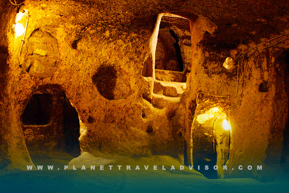
Between the seventh and twelfth centuries, waves of Arab–Byzantine conflict encouraged Christian villagers to extend their underground refuge in every direction. This is the era when most of Kaymakli’s distinctive features appeared: long ventilation shafts that double as chimneys, massive disk-shaped “millstone” doors weighing up to half a tonne, and blind corridors that lure intruders into dead ends while defenders watched from hidden apertures above.
After the eleventh-century Seljuk conquest, Greek-speaking Rûm communities continued the habit of ducking below ground whenever raiders or overzealous tax collectors arrived. Amazingly, villagers were still using parts of the complex as cellars and animal shelters well into the early twentieth century, until the population-exchange agreement between Greece and Turkey forced the last Orthodox families to leave Cappadocia in 1923.
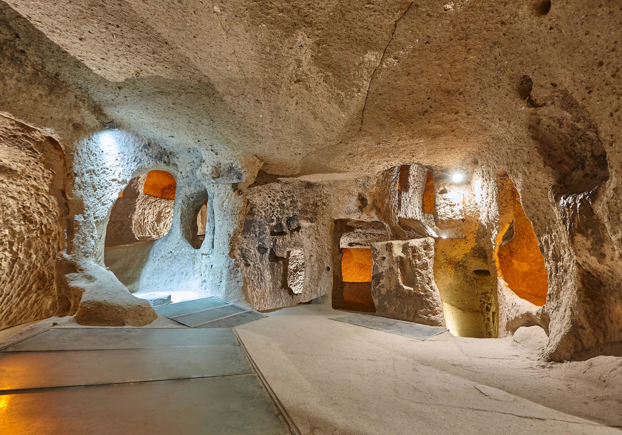
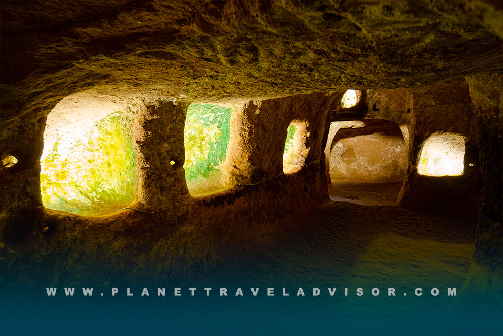
Mapping the Subterranean Metropolis of Kaymakli Underground City

Modern surveys have identified eight primary levels reaching roughly forty metres beneath the surface, though only the first four are currently open to visitors. At ground level, visitors pass through a short sloping corridor into former stables, immediately confronted by the first millstone door that once sealed the entrance. Ten metres below, a modest twin-apsed church, complete with a baptistery and clerical graves carved beside the altar, occupies the most spacious chamber on the second level.
A further descent leads to communal kitchens, tandoor ovens, and a remarkable andesite anvil studded with fifty-seven cup-like depressions, physical proof that residents could forge and repair copper tools without ever exposing their fire to outside eyes. One more flight of low, dusty steps brings you to level four, where vast granaries and amphora-lined food stores attest to months-long periods of sealed isolation. Beyond this point lie deeper ventilation shafts, armouries, escape passages, and the legendary corridor that once linked Kaymakli Underground City to its equally famous neighbour, Derinkuyu, almost ten kilometres to the south.
- Ventilation and Water
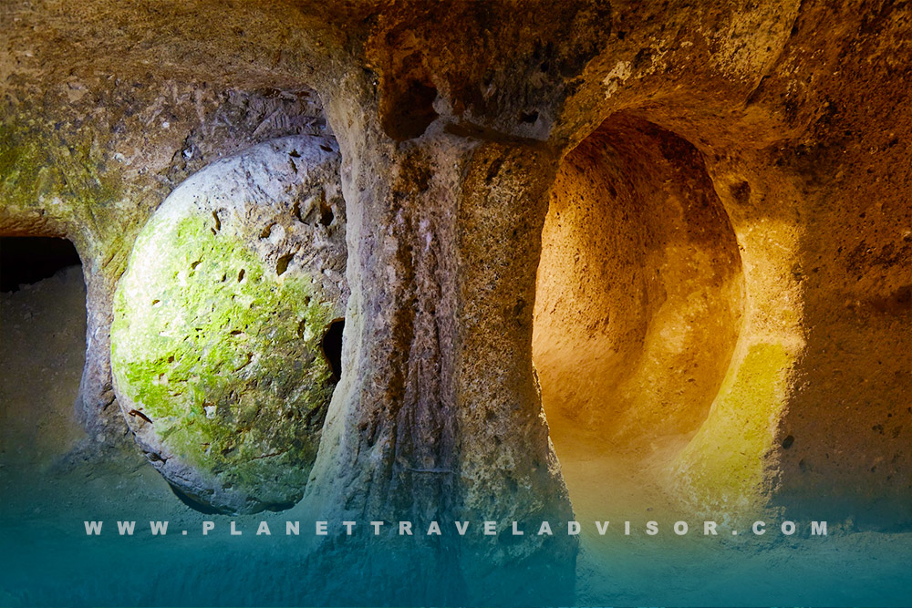
The “lungs” of the city are central shafts that plunge some eighty metres, drawing fresh air into clustered living rooms while serving as emergency wells when sieges stretched into weeks. Smoke and stale air rose naturally, creating a convection cycle that kept carbon-dioxide levels acceptable even with hundreds of people enclosed.
- Defensive Ingenuity
Kaymakli Underground City’s hallmark defence is the circular millstone door carved from solid andesite. Tunnels narrow to shoulder width just before each stone, forcing attackers to crouch single-file while defenders could roll the door across the passage and spear through its waist-high viewing hole. Many doorways still bear the chisel marks of their medieval masons; some millstones remain parked in their grooves, an eerie reminder that danger was no abstract concept for the people who lived here.
- Daily Life Below Ground
Archaeologists have catalogued forty-eight wine presses, multiple tandoor pits blackened with soot, ceiling hooks where meat once hung to cure, and ingenious shafts for olive pressing, evidence of a surprisingly normal domestic economy. Families slept in modest rock-cut chambers grouped around communal hearths while religious life centred on small chapels adorned with now-faded painted crosses. Copper working tools confirm that residents not only repaired agricultural implements but also minted their humble coins, ensuring basic commerce without exposing themselves to outside markets.
Size, Population, and Common Myths
Popular websites often repeat the romantic claim that Kaymakli Underground City housed twenty thousand people, yet engineering assessments based on storage capacity and air-flow modelling suggest a more realistic seasonal population of three to six thousand.
What Kaymakli lacks in depth compared with Derinkuyu, it reaches about forty rather than eighty-five metres, it compensates for in breadth, sprawling across roughly one hundred thousand square metres of rock and featuring multiple parallel corridors on each level rather than a single central descent. The layout makes it simultaneously the widest and, for modern visitors, the most maze-like underground settlement in Cappadocia.
Visiting Kaymakli Underground City in 2026

The entrance sits on the Nevşehir–Niğde highway just outside Kaymaklı village, twenty-five minutes by car or public minibus from Nevşehir. Opening hours run from eight in the morning until six in the evening between April and October, and one hour shorter in winter; last entry is always one hour before closing. Admission costs three hundred Turkish lira, about fifteen euros, or nothing at all if you hold a Türkiye Museum Pass. Crowds peak late morning when most day-tour buses arrive, so early birds at eight o’clock or late arrivers after half past four enjoy the quietest passageways. A typical self-guided visit lasts between sixty and ninety minutes, although a local guide can easily fill two hours with stories of Byzantine monks, secret schools, and olive-oil lamps hidden in ceiling niches.
Reaching Kaymakli Underground City without a car is straightforward: hourly minibuses leave Nevşehir’s main terminal and drop passengers at the village junction, from where it is a ten-minute walk. The round-trip fare in 2025 runs about forty-five lira. Many organised excursions follow Cappadocia’s popular “Green Route,” which normally prioritises Derinkuyu; travellers who specifically want Kaymakli should request the less crowded “Blue Route” or commission a bespoke tour.
Health and safety concerns are minimal but worth noting. Ceilings plunge to little more than one point two metres in several passages, obliging taller visitors to crouch. The stone floor is dusty rather than slick, yet sturdy closed-toe shoes remain essential, and a lightweight jacket is wise even in July because the air seldom rises above thirteen degrees Celsius. Those with severe claustrophobia may prefer Derinkuyu’s relatively wider galleries, while visitors with mild fears often find that the constant breeze from the ventilation shafts calms their nerves. Photography is permitted, though flash use is discouraged and tripods are banned in order to prevent congestion.
Deciding whether to hire a guide depends on your curiosity: the official signage is clear enough that most first-time travellers will understand the functional layout, but an accredited guide, currently charging roughly nine hundred lira per group, adds context you will not pick up on your own, such as how the placement of soot on certain ceilings proves that night-time cooking was standard practice to hide smoke.
Kaymakli Underground City Compared with Derinkuyu
Travellers often ask whether to visit Kaymakli or Derinkuyu if time is short. Kaymakli Underground City is the broader but shallower complex, famous for its copper-working anvil and maze-like parallel corridors.
Derinkuyu plunges twice as deep, featuring a cruciform ventilation shaft and a spacious underground missionary school, but follows a single main descent that can feel bottlenecked during high season. Both sites once connected through now-collapsed tunnels, highlighting a defensive network rather than two isolated refuges; each complements the other, so dedicated history buffs should ideally explore both.
Fascinating Facts about Kaymakli Underground City
Among many curiosities, the andesite anvil on level three is regarded as the oldest known subterranean metallurgical installation in Anatolia, dating to the tenth century. The circular stone doors each contain a peephole large enough to negotiate surrender terms, or launch a spear, without unsealing the passage. Local villagers still harvest grapes every September and ferment them in the same rock-cut niches that Byzantine monks once used, and because modern homes sit inside UNESCO’s legal buffer zone, homeowners must consult heritage engineers before digging new basements lest they breach an unknown corridor.
Conclusion: Kaymakli Underground City as Living History
Walking the shadowy passages of Kaymakli Underground City is less a tourist outing than a sensory journey through three thousand years of Anatolian resilience. Each crouched step whispers of Phrygian farmers escaping frontier raiders, Byzantine monks shielding sacred icons, and Ottoman-era villagers stockpiling wheat against a bitter winter. Whether you arrive as an archaeologist, a photographer chasing chiaroscuro in tuff-hewn vaults, or simply a traveller hungry for stories that lie beyond Cappadocia’s fairy-chimney skyline, Kaymakli rewards you with a rare, tangible lesson in how geography, ingenuity, and faith can conspire to create a subterranean world as vivid as any civilisation built in open sunlight. Emerge into the Central Anatolian daylight and you will understand why entire societies once chose to live, worship, and when necessary, survive beneath the earth’s protective embrace.
Experience our expertly curated Turkey tours, where every element, from fast-track access to iconic sites and boutique accommodations to insightful local guides, is crafted for immersive discovery. Book this week to unlock exclusive seasonal offers, limited spring and autumn departures, and explore Istanbul, Ephesus, and Cappadocia in comfort and style.