Summary
- Diverse Natural Marvels:
- Embark on a journey across the United States as we unveil 45 natural wonders, ranging from majestic landscapes and geological formations to breathtaking national parks, showcasing the incredible diversity of America's natural beauty.
- Iconic National Parks:
- Explore renowned national parks, such as Yellowstone, Grand Canyon, and Yosemite, delving into the unique features that make each park a must-visit destination for nature enthusiasts and adventurers alike.
- Hidden Gems and Off-the-Beaten-Path Treasures:
- Shine a light on lesser-known but equally stunning attractions, revealing hidden gems that captivate with their beauty and offer a more secluded and intimate connection with nature.
- Outdoor Adventure Hotspots:
- Cater to outdoor enthusiasts by highlighting natural attractions that provide opportunities for hiking, wildlife viewing, photography, and other recreational activities, ensuring a thrilling experience for those seeking adventure.
- Conservation and Sustainability Focus:
- Discuss the importance of conservation efforts and sustainable tourism practices in preserving these natural wonders for future generations, encouraging readers to explore responsibly and contribute to protecting these precious environments.
More Than 40 Wonders of America
The USA is home to natural attractions worldwide; the United States of America is surrounded by two oceans, bisected by the Mississippi River and the Rocky Mountains, and is home to spectacular natural attractions like the Grand Canyon and Niagara Falls. Thanks to the State and National Parks systems, beautiful natural attractions may be found in all 50 states and the U.S. territories. However, some natural attractions in the United States are worth going for and should be included on your bucket list.
These are among the best-known natural attractions in the USA. Aren't there any that you like? I can't even begin to name them all because there are so many. UNESCO has designated over a dozen national parks and natural wonders in the United States as World Heritage Sites, so you might also want to look at those.
In this travel guide, we will cover the top 45 natural attractions in the USA; every piece of content in this article is written by a travel expert who wants to share his passion for natural attractions, so prepare your coffee, and let's get started with:
- Yosemite National Park
- Grand Canyon
- Grand Canyon - National Park Service
- Grand Canyon Village
- Redwood National and State Parks (U.S)
- The Garden of the Gods Visitor & Nature Center
- Old Faithful, Yellowstone's Famous Geyser
- Monument Valley Navajo Tribal Park
- Hawaii Volcanoes
- Arches National Park (U.S)
- Acadia National Park (U.S)
- Crater Lake
- Denali National Park & Preserve (U.S)
- Rocky Mountain
- Columbia River Gorge
- Columbia River Gorge National Scenic Area
- Everglades National Park (U.S)
- Antelope Canyon
- Kilauea | U.S
- White Sands
- Devils Tower National Monument (U.S)
- Valley of Fire - Nevada State Parks
- Bryce Canyon
- Zion National Park (U.S)
- Niagara Falls State Park
- Carlsbad Caverns
- Luray Caverns
- Glacier National Park (U.S)
- Badlands National Park (U.S)
- John Pennekamp Coral Reef State Park
- The Great Smoky Mountains
- Waterfalls - Yosemite National Park (U.S)
- Waimea Canyon State Park
- Saguaro US
- Mount Rainier
- Grand Teton - National Park
- Death Valley
- Mount Washington
- Hocking Hills State Park
- Sequoia & Kings Canyon
- Black Hills & Badlands
- Upper Falls - Powerful Waterfall on the Yellowstone River
- Tahquamenon Falls State Park's Lower Falls
- Monument Rocks, the Chalk Pyramids – Kansas
- Hells Canyon National Recreation Area USA
1-Yosemite National Park
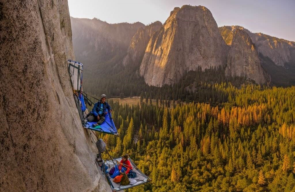
Yosemite is a national park in the United States, located in California. The Sierra National Forest and Stanislaus National Forest border east and west. The National Park Service manages the park, which covers an area of 759,620 acres (1,187 square miles: 3,074 km2) and is located in four counties: "Tuolumne, Mariposa, Mono, and Madera". Yosemite was designated a UNESCO World Legacy Site in 1984 for its sandstone cliffs, waterfalls, pure streams, enormous sequoia groves, lakes, mountains, meadows, glaciers, and biological variety. Almost 95% of the park has been declared wilderness. Yosemite is one of Sierra Nevada's most significant and least fragmented habitat blocks, and the park is home to a diverse array of flora and animals.
The park's height ranges from 2,127 to 13,114 feet (648 to 3,997 meters). It is home to five distinct ecological zones: chaparral and oak woodlands, minor montane forest, higher montane forest, subalpine zone, and the alpine. Around half of California's 7,000 plant species are found in the Sierra Nevada, and more than a quarter are found in Yosemite.
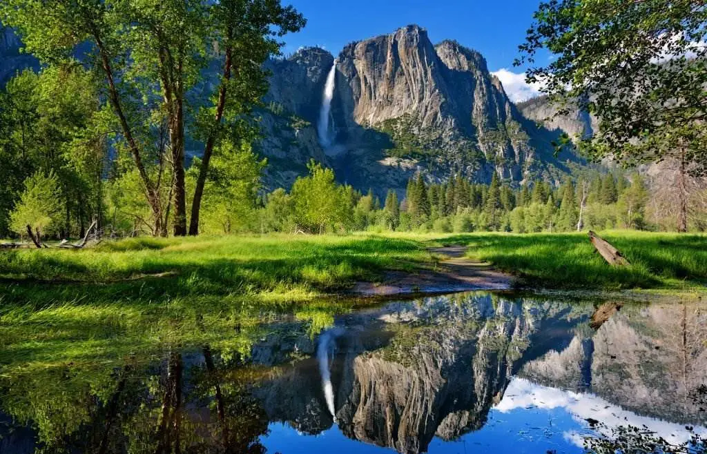
The park provides habitat for over 160 uncommon species, with peculiar local geologic formations and specific soils defining the restricted areas that many of these plants inhabit. Granite rocks and relics of earlier rocks characterize Yosemite's geology.
The Sierra Nevada was elevated and subsequently tilted approximately 10 million years ago, resulting in the mild western slopes and the more dramatic eastern slopes. As a result of the uplift, stream, and river banks became steeper, resulting in profound, slim canyons. Around one million years ago, snow and ice collected in the higher alpine meadows, generating glaciers that drifted down river valleys. During the early glacial event, There may have been ice as thick as 4,000 feet in Yosemite Valley. (1,200 meters).
The ice masses' downslope migration carved and molded the U-shaped valley that attracts many visitors today for its stunning panoramas.
2-The Grand Canyon
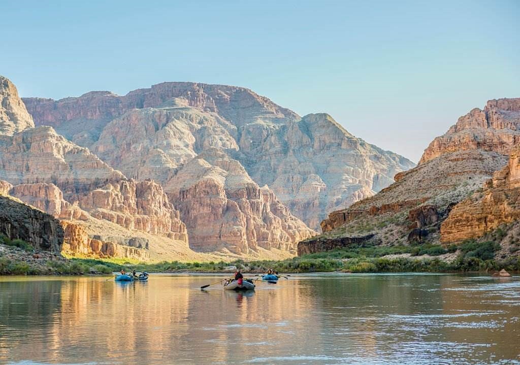
Visit the Grand Canyon's northern rim, home to one of its most breathtaking sights. The Grand Canyon Lodge North Rim has been a part of this picturesque location since 1928 and offers a variety of cabin and motel room options for your next visit. When you visit us for your next holiday, take advantage of all that the canyon and lodge have to offer. The Grand Canyon's most popular section is the South Rim.
Read Also: Best Time to Visit Grand Canyon 2025
Compared to the North Rim's 8,500 feet, the South Rim's 7,000 feet of elevation makes for some exhilarating descents, and the opposing cliff's intricate red-rock stairs appear like an enormous orange IMAX in front of you. If you're up for the challenge, the South Rim's hiking trails will repay your time and energy. At the very least, check out the Bright Angel or South Kaibab Trails.
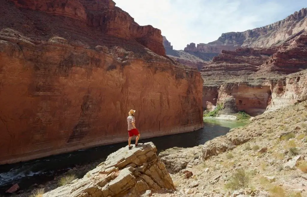
NORTH RIM allows you to enjoy a peaceful stroll. Only 10% of the park's approximately 5 million yearly visitors get it to this section of the Grand Canyon, making it less developed and more serene. Misanthropes will love this! If you want to combine a trip to Bryce, Zion, and Capitol Reef National Parks, the North Rim of the Grand Canyon is a great place to start. Hike the North Kaibab Trail or one of the short trails near the views. Most services at the North Rim shut down from mid-October to mid-May, but if the route hasn't been closed by snow, you might be able to travel there in the off-season.
Early spring through late October is the peak season for lodging, campgrounds, and guides. Be prepared.
3-The Grand Canyon - National Park
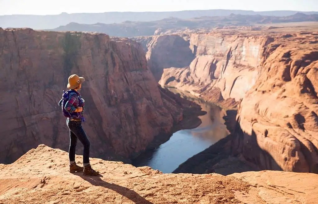
is the fifteenth national park established in the United States. The Grand Canyon is the park's centerpiece, a gorge formed by the Colorado River, sometimes called one of the World's Wonders. The park, which encompasses 1,217,262 acres (1,901.972 square miles: 4,926.08 km2) of unorganized land in Coconino and Mohave counties, attracted more than six million recreational visitors in 2017, ranking it second among all American national parks behind Great Smoky Mountains National Park.
In 1979, UNESCO proclaimed the Grand Canyon a UNESCO World Heritage Site. On February 26, 2019, the park will commemorate its centennial. After railroads were completed and pioneers developed infrastructure and early tourism, the Grand Canyon became well-known to Americans in the 1880s.
4-The Grand Canyon Village
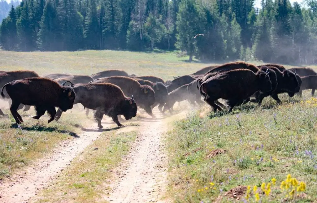
Grand Canyon National Park, the Kaibab National Forest Grand Canyon–Parashant National Monument, Hualapai, Havasupai, and Navajo Nation encompass the canyon and its neighboring rim. President Theodore Roosevelt strongly supported the Grand Canyon area's preservation and visited it multiple times to hunt and enjoy the grandeur.
The Colorado River and its branches exposed over two billion years of Earth's geological history when they censored their channels over layer after layer of rock as the Colorado Plateau was raised. While geologists disagree on critical details of the canyon's formation, several recent studies support that the Colorado River carved its path through the area approximately 5 to 6 million years ago. Since then, the Colorado River has pushed the tributaries and cliffs down, simultaneously deepening and enlarging the canyon.
5-Redwood National State Parks (U.S)
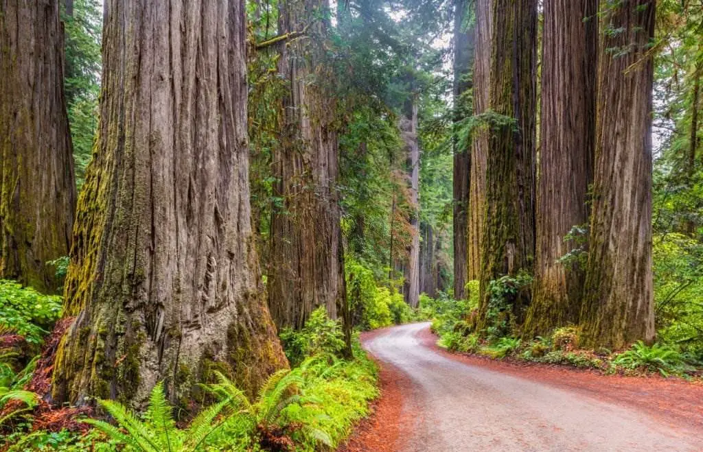
Redwood National and State Parks are a collection of four parks in northern California, one of which is a national park and the other three jointly maintained. The United RNSP contains 139,000 acres (560 km2) of old-growth temperate rainforests, including Redwood National Park (created in 1968) and California State Parks: Del Norte Coast, Jedediah Smith, and Prairie Creek (dating from the 1920s). At a total of 38,982 acres, in the four parks in Del Norte & Humboldt Counties forty-five percent of the remaining coast redwood (Sequoia sempervirens) (157.75 km2).
These trees are some of the largest and oldest on the planet. There are 37 miles (60 km) of pristine shoreline, various native plant and animal life, and grassland prairie. Social elements are also protected, as are sections of rivers and streams.
6-The Garden of the Gods Visitor & Nature Center
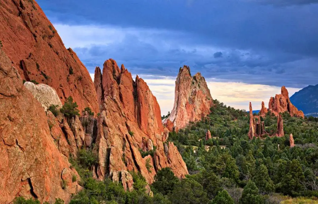
The Garden of the Gods Visitor & Nature Center is open daily from 9:00 a.m. to 5:00 p.m. The park is open from 5:00 a.m. to 9 p.m. from November through April and 5:00 a.m. to 10 p.m. from May through October. Here, the pinon-juniper forests of the American Southwest mix with Great Plains grasslands, and the 14,115-foot Pikes Peak – America's Mountain – rises above the landscape.
With its 300 million years of geological history, the Garden of the Gods in Colorado Springs offers one of the most comprehensive portraits of Earth's past anywhere in the country. It's a natural wonder.
7-Old Faithful, Yellowstone's Famous Geyser
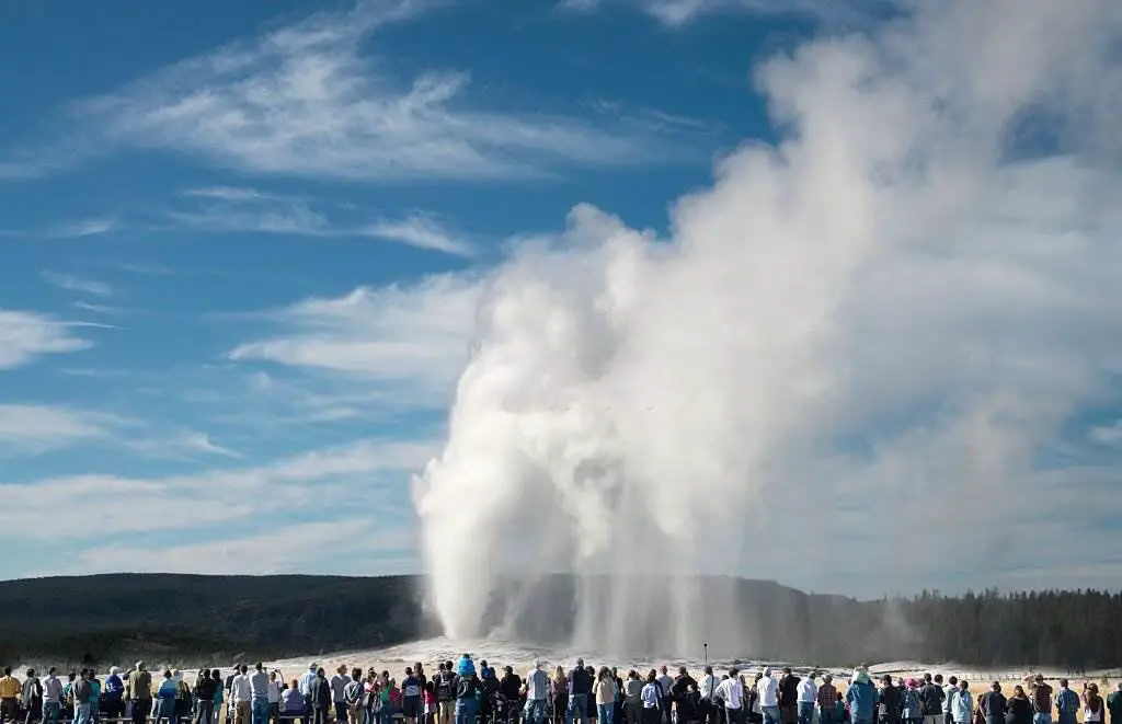
Yellowstone's Upper Geyser Basin is home to the park's most famous geyser, Old Faithful. To help visitors better understand the geyser's behavior, a ranger station monitors the eruption's start time, height, and duration to predict when the next one will occur. With a range of 100-180 feet, Old Faithful is typically around 130-140 feet tall. In the past, its height has been measured in this range.
Read Also: Best Time to Visit Yellowstone 2025
On average, eruptions commonly last between 1.5 and 5 minutes. Old Faithful in Yellowstone, the world's most famous geyser, erupts roughly 20 times daily.
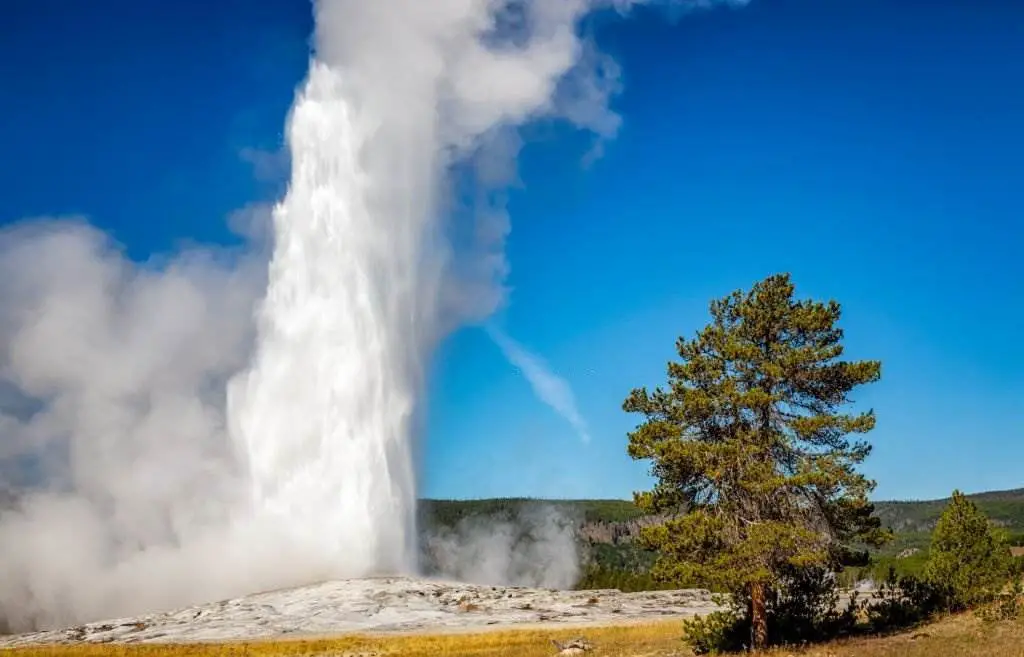
Based on the preceding eruption's duration and height, these eruptions can be forecast with a 90% confidence level and a 10-minute variation. After hours, geyser forecasts and statistics are kept by the naturalist crew. Observation, timing with a stopwatch, and recording findings in a logbook are the best methods for accomplishing this.
8-Monument Valley Navajo Tribal Park
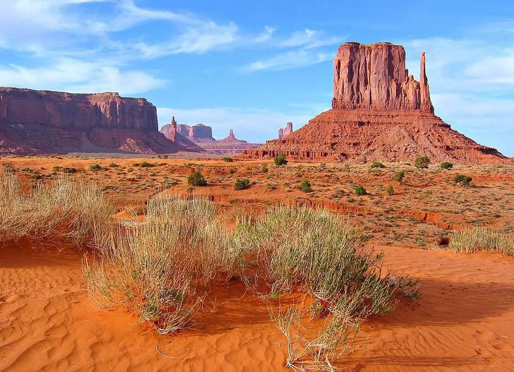
The 17-mile circular route has regenerated and now accepts only five automobiles per hour, under the NNDOH's 50% residence limit at all tribal park conveniences. With the Winter hours in force, we want to remind all tourists that all entrances are on a "First Come, First Served" basis. Due to the rocky terrain, watch for all low-level vehicles. We request that you anticipate longer wait times and harsh weather.
Follow all signage, remain on the approved route, and stay hydrated and safe. Our primary concern is for the protection of our citizens. It is one of the planet's most gorgeous – and photographed – locations.
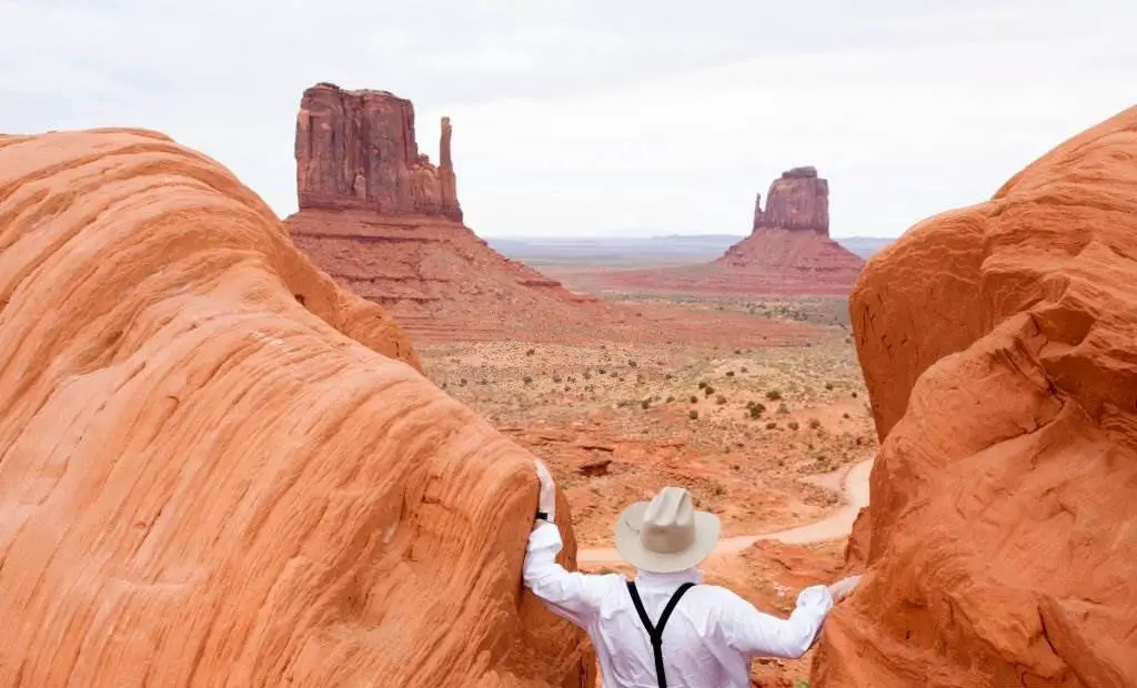
This magnificent valley is home to sandstone marvels that soar to 400 to 1,000 feet and are framed by gorgeous clouds that send graceful shadows on the desert floor. The sun's perspective highlights these exquisite patterns, creating awe-inspiring vistas. The environment is overwhelming, not only in terms of beauty but also in terms of scale.
The fragile rock pinnacles are flanked by miles of mesas and buttes, plants and trees, and windblown sand, all contributing to the valley's beautiful colors. All of this combines to provide a genuinely spectacular experience at Monument Valley. Take advantage of this lovely land.
9-Hawaii Volcanoes National Park
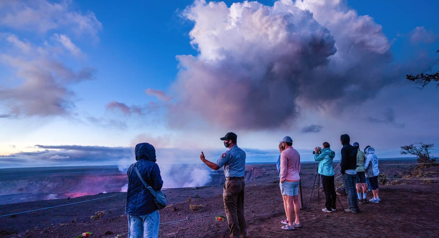
Kilauea, one of the most active volcanoes on the planet, may be found in the park. One of Hawaii's most popular tourist attractions, and a sacred location, is the Big Island's Volcanoes National Park. From the top of Maunaloa to the ocean, Hawaii Volcanoes National Park spans 335,259 acres, or nearly 523 square miles (by comparison, the island of Oahu is 597 square miles). A tourist center, petroglyphs, Maunaloa (which last erupted in 1984), and Kilauea (which last erupted in 2018) are among the highlights of the region's 150-mile network of hiking trails (1983-2018). Many people call Kilauea "The only drive-in volcano in the world".
Read Also: Best Time To See The Lava in Hawaii 2025
On any day, this active volcano would spew out enough lava to cover the surface of a 20-mile two-lane road. More than 875 acres of land have been added to the island of Hawaii since January 1983. UNESCO declared the park a World Biosphere Site in 1980 and a World Heritage Site in 1987 to recognize the region's exceptional ecological variety.
10-Arches National Park (U.S)
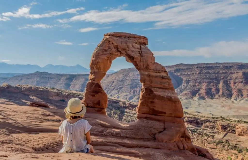
Arches National Park is a United States national park located in eastern Utah. The park is located just north of Moab, Utah, about 4 miles north of the river. Delicate Arch is just one of many natural sandstone arches that can be seen in the park, along with other unique geological features and structures. This park has more natural arches than any other in the world.
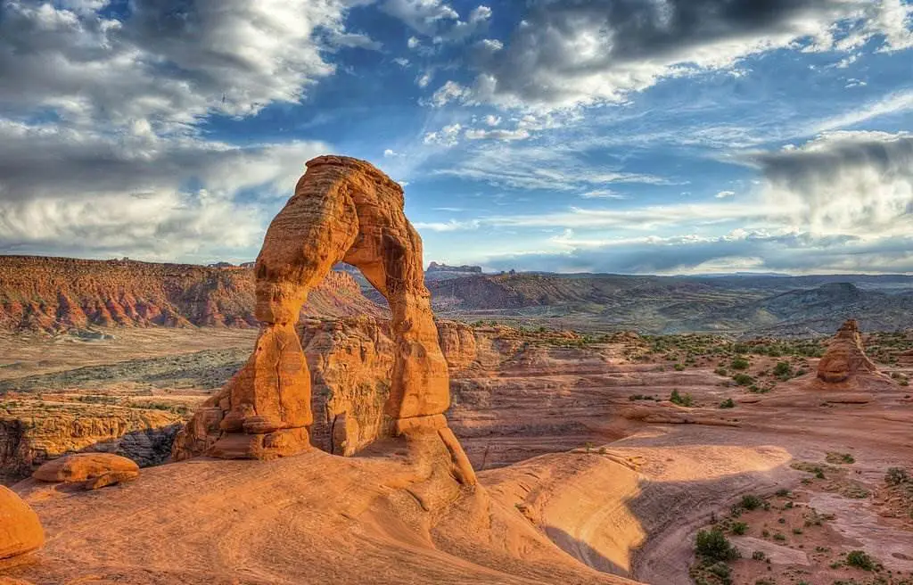
For more than three-and-a-half million square feet (76,680 acres), the park is located on the Colorado Plateau and spans 310.31 square kilometers. Elephant Butte, the park's highest point, rises to a height of 5,653 feet (1,723 meters) while the visitor center, at 4,085 feet (1,245 meters), is the park's lowest point. The average yearly rainfall is below the 10-inch mark (254 millimeters).
On April 12, 1929, the National Park Service designated the area a national monument, and on November 12, 1971, it was renamed a national park. In 2018, around 1.6 million people visited the park.
11-Acadia National Park (U.S)
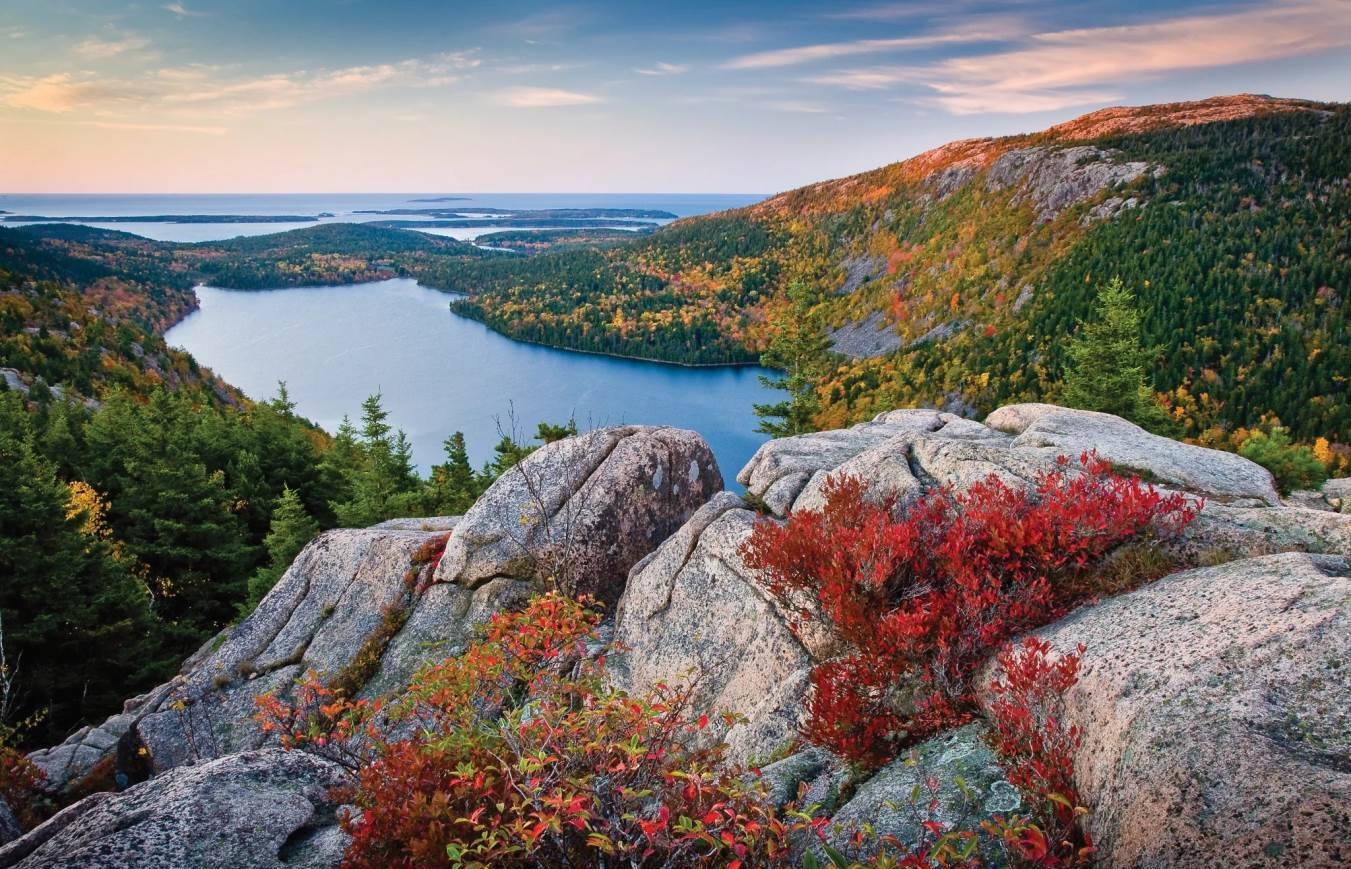
This national park preserves the natural grandeur of the highest rocky headlands along the Atlantic coast of the United States, a plethora of habitats, and a rich cultural history. It is one of the most popular national parks in the United States, with an average of 3.5 million visitors annually. There are 27 miles of historic motorways, 158 miles of hiking trails, and 45 miles of carriage roads for visitors to explore.
On the coast of Maine, the United States, there is a spectacular national treasure known as the Isle au Haut. Natural beauty abounds no matter which vantage point you choose. Unsurprisingly, it is one of the most popular parks in North America and the United States. Located on Mount Desert Island's northeastern coast, the little seaside town of Bar Harbor enjoys a special bond with the nearby Acadia National Park.
12-Crater Lake
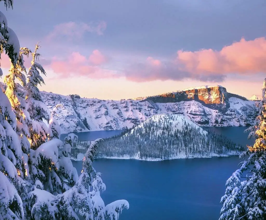
Located in Southern Oregon's Cascade Mountains, Crater Lake National Park is home to the seventh-deepest lake in the world and the country's deepest lake. The caldera, or volcanic basin, where the 1,943-foot-depth lake is located, was shaped after the 12,000-foot-high Mount Mazama distorted 7,700 years ago after a massive eruption. To maintain its crystal-clear appearance, the lake relies on snowfall.
Mount Hood and Mount McKinley are the park's most prominent landmarks. The park's varying elevations provide various habitats for various creatures, making it an excellent outdoor classroom and laboratory.
13-Denali National Park & Preserve (U.S)
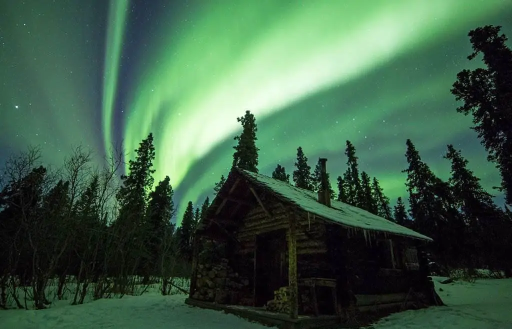
Denali National Park and Preserve, home to North America's tallest mountain, Denali, is a U.S. national park in Alaska's interior. More than the entire state of New Hampshire, the park and its neighboring preserve 6,045,153 acres (9,446 square miles; 24,464 square kilometers).
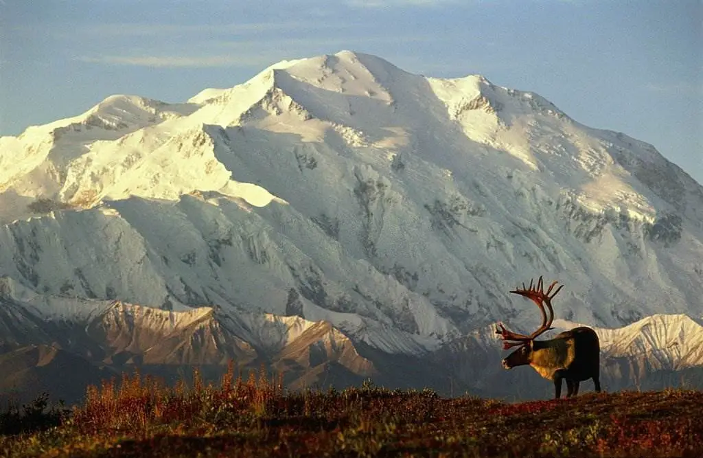
The 2,146,580-acre Denali Wilderness was established in the park on December 2, 1980. In the lower elevations of Denali, you'll find deciduous taiga, tundra, and glaciers; at the middle elevations, you'll find bare rock, snow, and glaciers. The Kahiltna Glacier is the longest in the world. Skiing, snowmobiling, and dog sledding are popular winter pastimes. In 2018, the park welcomed 594,660 recreational guests.
14-Rocky Mountain
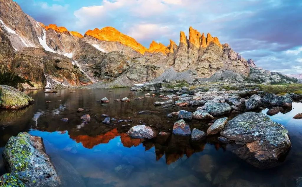
North America's largest and most prominent mountain ranges. In a straight line, the Rocky Mountains cover an area of 4,800 km2 and extend from northernmost British Columbia, Canada, to New Mexico, USA.
Its northern terminus can be found in the Terminal Range in northern British Columbia, south of the Liard River and east of the Trench, or in the northern foothills of the Brooks Range/British Mountains, which face the Beaufort Sea coasts between the Canning and Firth Rivers across the Alaska-Yukon border, depending on definitions differing between Canada and the United States.
New Mexico's Rio Grande Basin and the Sandia–Manzano Mountains are to the north of its southernmost point. The Rockies are unique from the tectonic activity newer the Cascade Range and the Sierra Nevada, which lie further to the west since they constitute the easternmost part of the North American Cordillera.
Colorado, Wyoming, New Mexico, Montana, and Utah are home to most of the Rocky Mountains' tallest peaks with a 500-meter topographic prominence (78 of the 100, including the 30 highest). Mountaineering, camping, fishing, hunting, mountain biking, snowmobiling, skiing, and snowboarding are just a few activities in the area's public parks and forests.
15-Columbia River Gorge
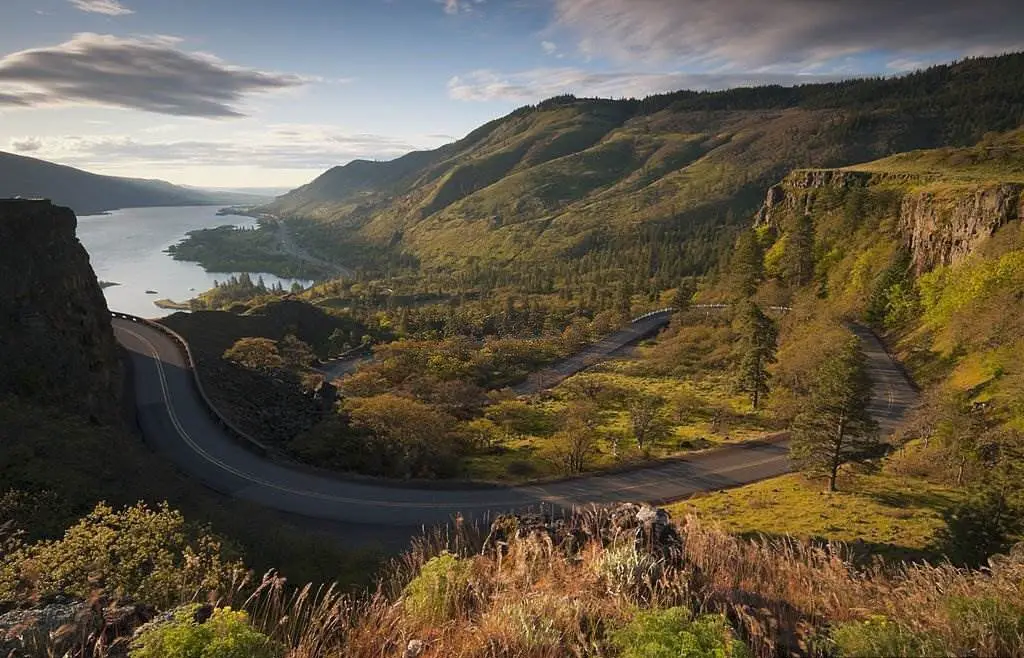
It's an esoteric Columbia River gorge in the United States Pacific Northwest. The river cuts a 130-mile (240-kilometer) swath through the Cascade Mountains as it flows westward, providing a natural border between Washington and Oregon at a depth of up to 1,200 meters (4,000 feet).
The only navigable path over the Cascade Mountains and access to the Pacific Ocean is provided by the water gap between the Columbia Plateau and the Pacific Ocean (approximately from the confluence of Columbia and Deschutes Rivers in the east to the eastern outskirts of Portland urban area in the west). Interstate 84, US Route 30, Washington State Route 14, and train tracks comprise this corridor.
The Columbia River Gorge Commission and the U.S. Forest Service jointly manage the gorge, a popular tourist destination designated as the Columbia Gorge National Scenic Area by the federal government.
16-Columbia River Gorge National Scenic Area
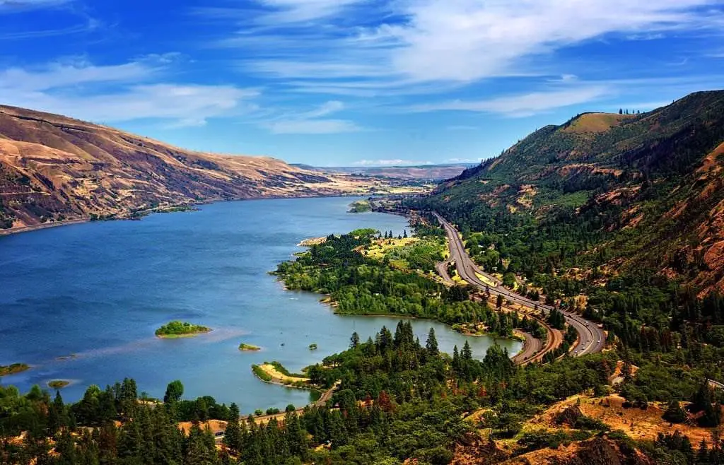
Incredible natural beauty may be seen in the Columbia Gorge. This diverse ecosystem, which includes everything from tropical rainforests to arid grasslands, has the largest concentration of waterfalls in North America and is home to innumerable bird, fish, and plant species, including 15 unique species of wildflowers.
Many people live in the Gorge because of its natural beauty and sensitive community-nature balance. However, this equilibrium has been and continues to be jeopardized by the development demands.
17-Everglades National Park (U.S)
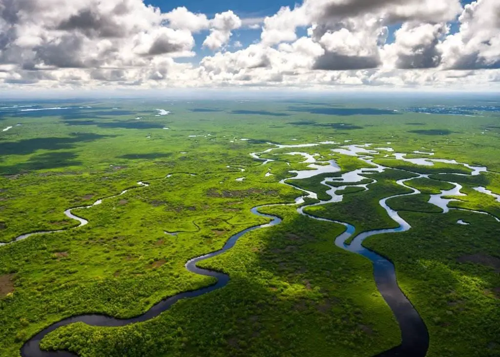
The Everglades is a 1.5 million-acre wetland area in southern Florida. Planning is essential because the park spans a vast swath of southern Florida. Everglades National Park has three entrances, none connected; visitors must travel to separate parts of South Florida to reach each one. Every one of these locales has a vast choice of things to do! On the Anhinga Trail, you can see many species, including turtles, herons, and alligators! To get a bird's eye perspective of the glades, climb the 65-foot observation tower at Shark Valley. To see crocodiles, manatees, and dolphins in their natural habitat, take a boat or kayak tour of Florida Bay, Mainland Florida's southernmost point, Flamingo is the perfect place to catch the sunset.
The pinelands can be explored on a bike, the Nine-Mile Pond can be paddled through the mangroves, or the historic Nike Hercules missile facility can be visited. You'll have to slog through a cypress dome to get there. Camping along the Wilderness Waterway's 99-mile length is an excellent opportunity to escape it all for a week. The Everglades National Park in Florida protects the southern twenty percent of the original Everglades in Florida. Located east of the Mississippi River, it is the largest tropical forest in the United States and the largest wilderness east of the Mississippi River. The park attracts an average of one million visitors each year.
In the contiguous United States, the Everglades National Park is third in size behind Death Valley and Yellowstone. The Ramsar Convention classified the park as a Wetlands of International Importance 1987. UNESCO established the Everglades & Dry Tortugas Biosphere Reserve in 1976 and listed it as a World Heritage Site in 1979.
Only three places, including the Everglades, have made all three lists. Everglades National Park was the first to be established to save a particularly vulnerable ecosystem. Wetlands and woodlands are nourished by a river that flows out of Lake Okeechobee, southwest into Florida Bay, every day. The park's mangrove ecology is the largest in the Western Hemisphere, making it an important nesting place for tropical wading birds. In addition to the Florida panther and the American crocodile, there are 350 species of birds, 300 kinds of fresh and saltwater fish, 40 species of mammals, and 50 species of reptiles that call the park home. The Biscayne Aquifer, which holds most of South Florida's freshwater, is refilled at the park.
18-Antelope Canyon
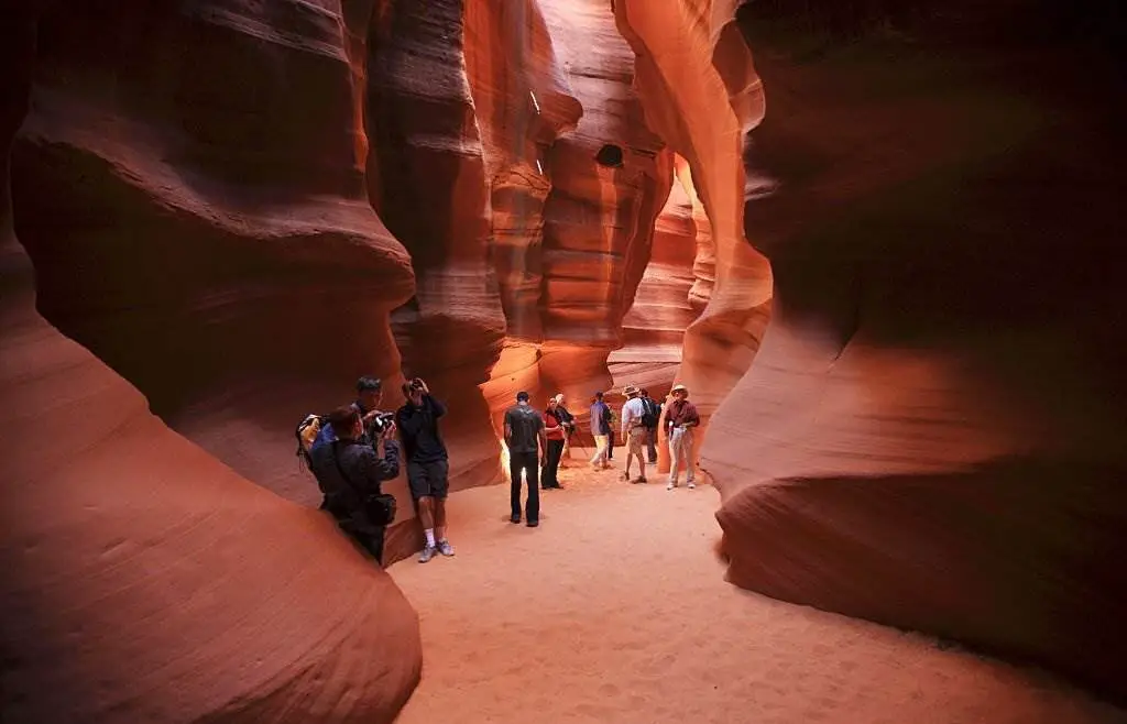
A slot canyon is located in the American Southwest, east of Lychee, Arizona. One of the Navajo Reservation's most popular tourist attractions, it consists of five unique, beautiful slot canyon portions, each of which is referred to as "The Crack" "Rattle Snake" "Owl" "Mountain" or "The Corkscrew". It is the park's most famous feature with a trail leading to Rainbow Bridge National Monument.
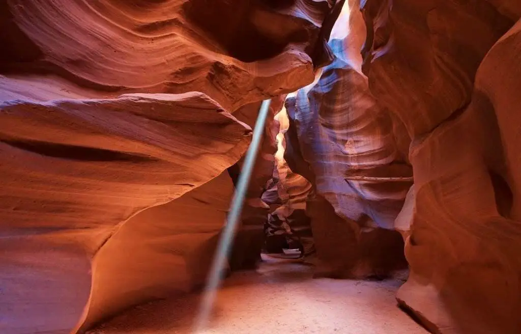
Navajos refer to Upper Antelope Canyon as "the location where water is running through the (Slot Canyon) rocks," hence the name Tsé bighánln. The Navajo Parks and Recreation Division refers to the spiral rock arches' in Lower Antelope Canyon as "Hazdestwazi." Only a Navajo guide can give you entrance to these two Navajo sites, which are located in the LeChee Chapter of the Navajo Nation.
19-Kilauea U.S
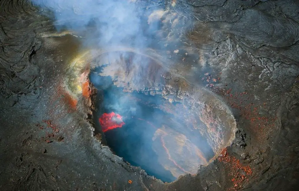
Kilauea is a Hawaiian shield volcano still erupting lava into the atmosphere. The Big Island of Hawai'i comprises five volcanoes, the most active of which is Kilauea. About 100,000 years ago, a volcano erupted on the island's southeastern shore. The Hawaiian–Emperor seamount chain's present eruptive center, is the second-youngest product of the Hawaiian hotspot.
Kilauea was initially believed to be a satellite of Mauna Loa due to its lack of topographic prominence and historical coincidences with its activity. One rift zone extends 125 kilometers (78 miles) east and the other 35 kilometers (22 miles) west of the top of Kilauea as an active fault that moves vertically an average of 2 to 20 millimeters per year.
20-White Sands National Park
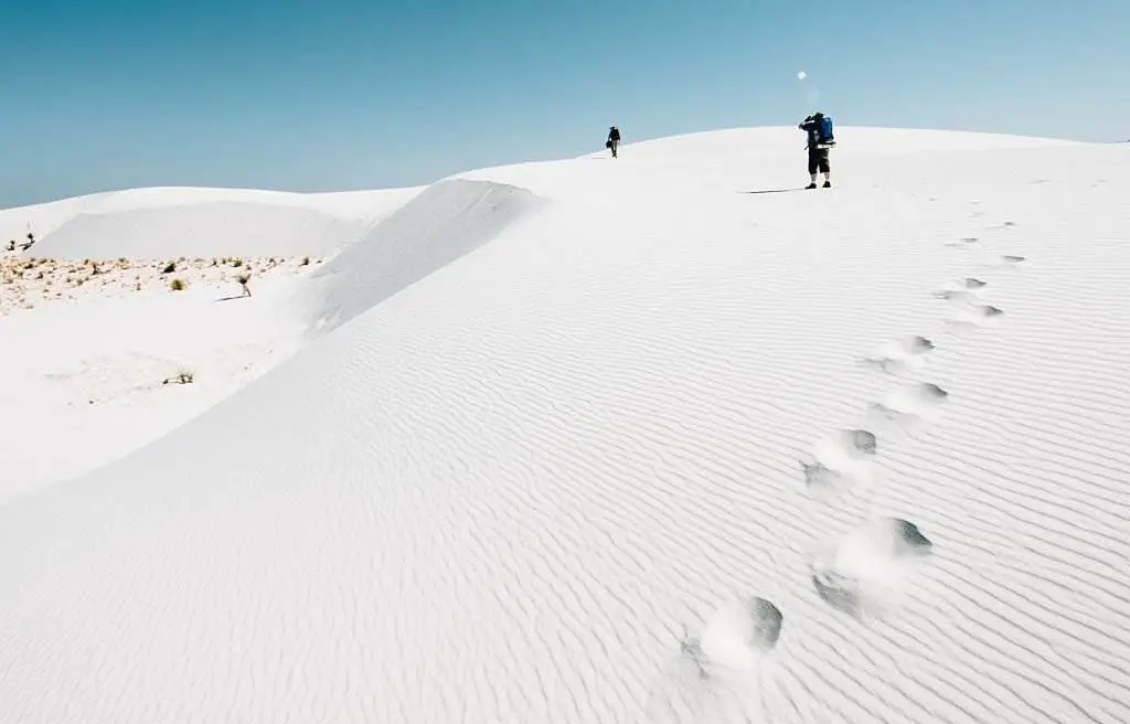
White Sands is a U.S. national park in New Mexico, bordered by the White Sands Missile Range on its entire eastern boundary. All of the Tularosa Basin's 145,762 acres (227.8 square miles, 589.9 square kilometers) of white dunes, which are constructed of crystals made of the mineral gypsum, are included in the park.
In all, the largest gypsum dune field in the world is 30 feet (9.1 meters) deep, has dunes up to 60 feet (18 meters) high, and contains around 4.5 billion short tonnes (4.1 billion metric tonnes) of the mineral. Tularosa Basin terrain was home to Ice Age mammals and vast lakes, streams, and grasslands 12,000 years ago.
Rain and snowfall from the neighboring mountains dissolved gypsum and brought it into the basin as the environment warmed. Selenite crystals formed due to further warming and drying of the lakes. The crystals, broken up by strong winds, were then carried eastward by the wind.
21-Devils Tower National Monument (U.S)
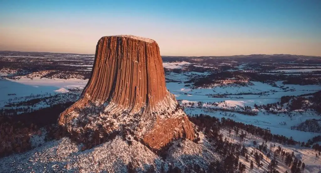
The first U.S. national monument was designated in 1906 in north-easterly Wyoming near the Belle Fourche River and was known as Grizzly Bear Lodge. An eroded volcanic intrusion has uncovered a natural rock tower, which is currently 2.1 square miles (5.4 square kilometers) in area. The tower's flat top and fluted sides cover 0.6 hectares of land.
With an elevation of 5,112 feet above sea level, it stands 867 feet (264 meters) above the ground and 1,267 feet (386 meters) over the river valley. The tower was most likely created when molten rock was pushed upward and forced to spread out by a hard rock layer. Light grey and buff are the primary colors of this item.
The top of the tower is covered in lichens, sage, moss, and grass. The tower's peak is home to chipmunks, birds, and a pine forest. A large prairie dog settlement may be found at the tower's base.
22-Valley of Fire - Nevada State Parks
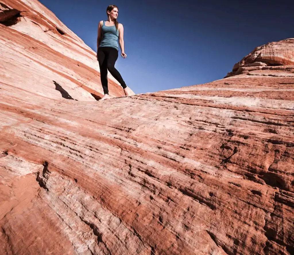
Park visitors can marvel at the Valley of Fire State Park's 40, 000 acres of vivid red Aztec sandstone outcrops hidden among grey and brown tan limestone. Exhibits on the park's geology, ecology, prehistory, and history can be found in the visitor center. Participants compete with reproductions of ancient spears in an annual Atlatl Competition held at the park.
In addition to multiple campsites with shaded tables, grills, and water, the park offers a variety of hiking routes that are sure to entice visitors. Creosote bush, burro bush, and brittlebush dominate the local plant community. These include beaver tail and cholla varieties, among others. Along park roads, desert marigolds, indigo bush, and desert mallow bloom in the spring, making for a magnificent sight.
23-Bryce Canyon National Park
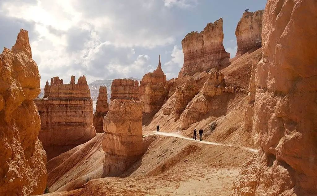
Bryce Canyon National Park attracts more than two million tourists annually, most visiting between March and early October. Most people plan to stay for at least a full day when they come to visit. No matter how long you stay, developing a game plan in advance will help you make the most of your time here.
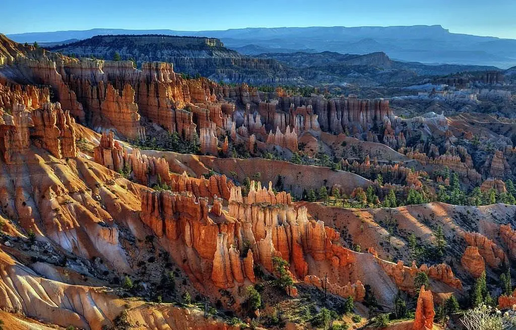
Natural amphitheaters or bowls formed into the side of a high plateau make up Bryce Canyon. The Bryce Amphitheater is the most well-known, with its hoodoos, or unevenly eroded rock spires. Bryce Point, Inspiration Point, and Sunrise Point are all located within a few miles of each other in the park's initial few miles of exploration.
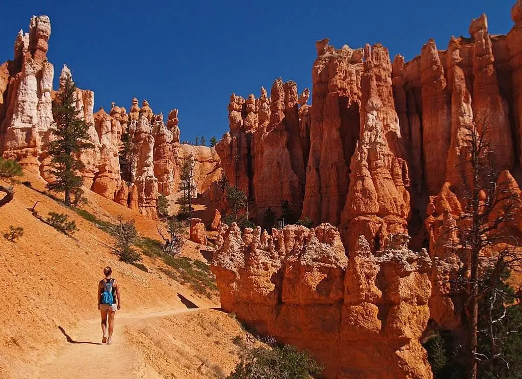
A shuttle service that runs from April to October alleviates congestion in this area. Other sights may be discovered on the 18-mile main route, which runs from its northernmost entrance along the plateau rim to its southernmost, highest altitudes (over 9,003 feet/2,743 meters). Hiking routes traverse the plateau's woodlands, connect overlooks along the Bryce Amphitheater's rim, and meander among the hoodoos below.
24-Zion National Park (U.S)
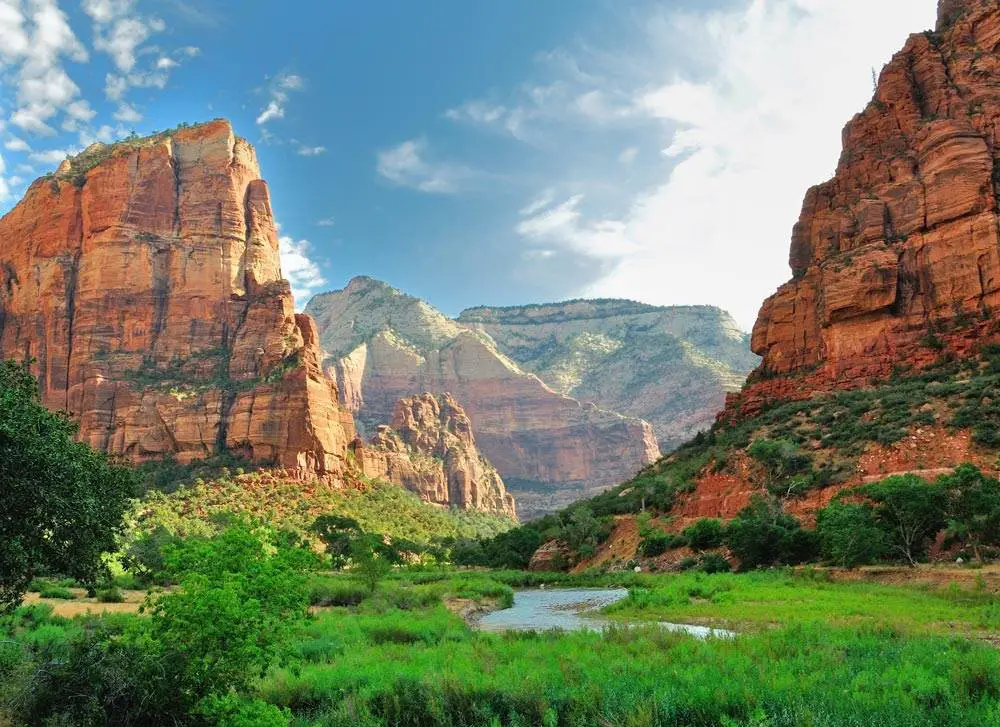
Zion National Park is a U.S. national park in the state of Utah, close to the city of Springdale. One of the park's most notable features is Zion Canyon, a 15-mile (24-kilometer) long and up to 2,640-foot (800-meter) deep canyon.
The North Fork of the Virgin River has eroded reddish and tan-colored Navajo Sandstone off the canyon walls. Coalpits Wash is the park's lowest point at 3,666 feet (1,117 m), while Horse Ranch Mountain is the highest at 8,726 feet (2,660 m). The park's unique location at the nexus of the Colorado Plateau, Great Basin, and the Mojave Desert, as well as its diverse range of life zones, allow for a surprising range of plant and animal life.
The park's four life zones (desert, riparian, woodland, and coniferous forest) are home to 289 species of birds, 75 animals (including 19 bats), and 32 reptiles. Mountain ranges, canyons, mesas, monolithic sandstone cliff faces, rivers and gorges, and natural arches abound in Zion National Park.
25-Niagara Falls State Park
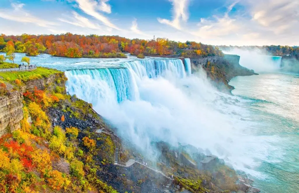
It is located in Niagara Falls, New York, United States, in Niagara Falls. American Falls, Bridal Veil Falls, and a portion of Horseshoe Falls are all part of this park, the nation's oldest state park (also known as the Canadian Falls). A flight restriction in the Niagara Falls State Park region amounts to a no-fly zone by FAA rule 14 CFR 93 Sub E. Niagara Falls State Park does not allow unmanned aerial systems (UAS) since all flights below 3,500 feet are forbidden. There will be no permit issued.
26-Carlsbad Caverns
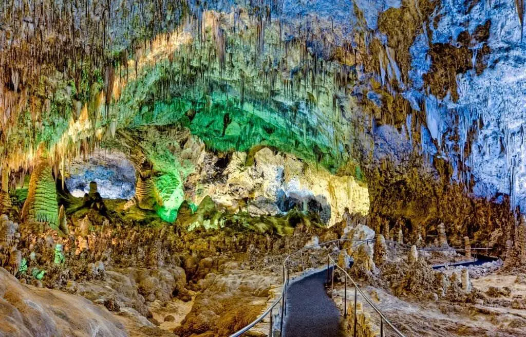
Carlsbad Caverns National Park is located in the Guadalupe Mountains of New Mexico. This park's centerpiece is the Carlsbad Caverns exhibit cave. The natural entrance to the cave is accessible only by foot, although an elevator is also available at the cave visitor center for those who prefer that option. About 18 miles (29 kilometers) southwest of Carlsbad, New Mexico is the park's main entrance on US Highway 62/180. This national park participates in the Junior Ranger Program; the Rattlesnake Springs Historic District and the Caverns Historic District are listed on the National Register of Historic Places.
The park has been divided into approximately two-thirds of wilderness areas to ensure that no future changes are made to the habitat. The Big Room in Carlsbad Cavern is a massive limestone chamber with a circumference of 625 feet (191 meters), a width of 625 feet (191 meters), and a height of 255 feet (78 meters) at its highest point. The Big Room is the third-biggest chamber in the world and the largest in North America.
27-Luray Caverns
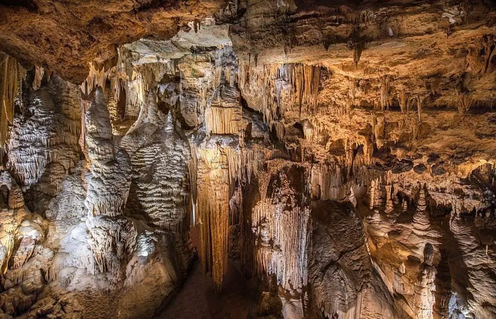
Since its discovery in 1878, it has been a popular tourist attraction in Virginia, United States. There are numerous speleothems in the cavern system, including stalactites, stalagmites, flowstone, columns, mudflows, and mirrored pools.
With its lithophone created from solenoid-fired strikers that tap various-sized stalagmites to produce tones akin to those of xylophones, tuning forks, or bellows, the cavern is arguably most known for its Great Stalacpipe Organ. An 1880 investigation by the Smithsonian Institution found, "It is safe to declare that there has been possibly neither any cave in the world more entirely and richly ornamented with stalagmite and stalagmite adornment than Luray."
28-Glacier National Park (U.S)
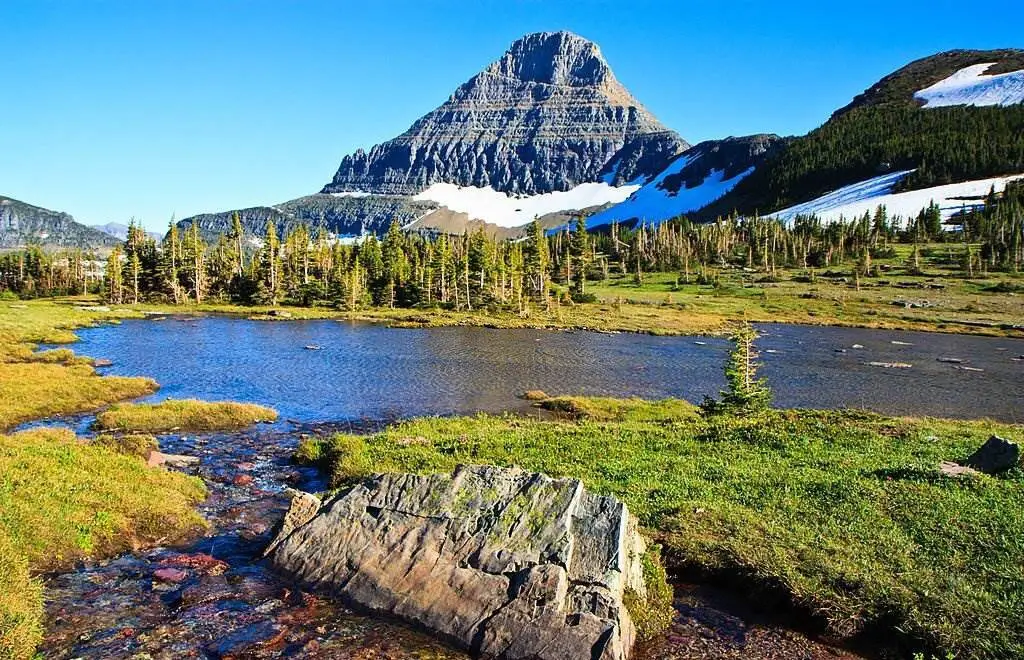
Glacier National Park is in northeastern Montana and borders Alberta and British Columbia. Over 130 named lakes, over 1,000 distinct species of vegetation, and hundreds of different species of animals can be found inside the park's 4,000 square kilometers (1 million acres). The "Crown of the Continent Environment" which encompasses 16,000 square miles of protected territory, is the centerpiece of this immense pristine ecosystem (41,000 km2). Native Americans were the first to settle in the area that would become Glacier National Park. The Blackfeet ruled it in the east and the Flathead in the west when European explorers arrived.
In 1895, the Blackfeet were forced to give up the mountainous portions of their treaty territory to the federal government, which were ultimately included in the park. Several hotels and chalets were built by the Great Northern Railway soon after the park opened on May 11, 1910. 350 historic hotels and chalets, including these National Historic Landmarks, are on the National Register of Historic Places. Going-to-the-Sun Road, later declared a National Historic Civil Engineering Landmark, was constructed in 1932, allowing for broader access to the park's interior by automobile for the first time.
29-Badlands National Park (U.S)
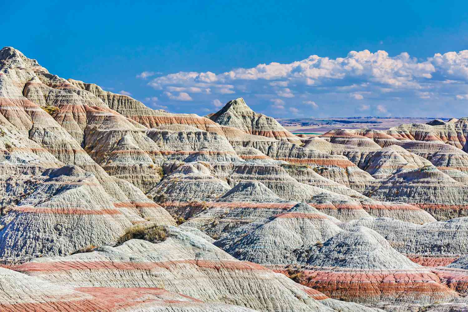
Badlands National Park is a national park in South Dakota in the United States. The park protects highly eroded buttes and pinnacles covering 242,756 acres (379,3 sq mi, 982,4 km2) and the country's largest intact mixed-grass prairie. The South Unit of the park is co-managed by the Oglala Lakota tribe and the National Park Service. 64,144 acres (100.2 sq mi, 259.6 km2) of the Badlands Wilderness are designated wilderness areas, and one of the most endangered creatures on Earth was reintroduced at this location.
Located in the Stronghold District, the park's South Unit is home to the historic Ghost Dances site, a former US Air Force bomb and gunnery range, and the 3,340-foot-high Red Shirt Table (1,020 m). It was not until 25 January 1939 that the Badlands National Monument was officially formed, despite being authorized as such on March 4, 1929.
On November 10th, 1978, Badlands became a national park. During the construction of the Ben Reifel Visitor Center in 1957–58, the Mission 66 plan was implemented for the monument. As a bonus, the Minuteman Missile National Historic Site is under the auspices of the park. Badlands National Park was used as a location for the films Dances with Wolves and Thunderheart.
30-John Pennekamp Coral Reef State Park

On Florida's Key Largo, there's a Florida State Park named Fort Jefferson. Around 70 nautical square miles of nearby Atlantic Ocean seas comprise this area. At a distance of 3 miles from land, the park is around 25 miles long, it was the country's first and only underwater theme park. As of April 14, 1972, the National Park Service officially recognized the park as a historic landmark.
The park's coral reefs such as "The Molasses Reef" and the marine life are the principal draw of the area. The park attracted over a million visitors in the Fiscal Year 2004, making it the most popular state park in Florida. In the continental United States, there are just two live coral reefs: in the Gulf of Mexico off the coast of Texas and in the Florida Keys.
31-The Great Smoky Mountains
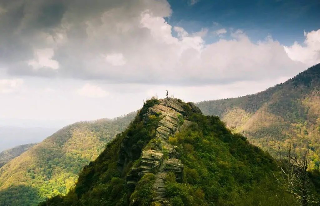
The Great Smoky Mountains, the most popular national park in the United States, is a beautiful vacation spot. Explore one of the oldest mountain ranges in the United States while hiking and camping. On the North Carolina-Tennessee border, the Great Smoky Mountains National Park is built of ridges upon ridges of dense woodland.
Due to the constant morning fog, this mountain range has been dubbed the "Smoky Mountains" and is known for its richness of plant and animal life, the majesty of its ancient mountains, and the history of southern Appalachian mountain culture. Great Smoky Mountains National Park has many attractions, including more than 80 historic buildings, stunning wildflower displays, and abundant wildlife.
The Tennessee-North Carolina line divides the Great Smoky Mountains National Park region in half. Over the state line, separated by many miles of deciduous woodland, two visitor centers stand to mirror images of one another, Sugarlands and Oconaluftee. More than 200,000 people visit Grotto Falls in Yosemite National Park each year because it is one of the park's most popular attractions.
Lie in the Southeast United States, straddling the Tennessee-North Carolina state line, is the highest point in that region. The Blue Ridge Physiographic Province encompasses the Appalachian Mountains and their tributaries. The Smoky Mountains and the Smokies are common names for the mountain range. In addition to being home to the Great Smoky Mountains National Park, the Great Smoky Mountains are also noted for their rugged beauty. Over 11 million people visit it each year, making it the most visited national park in the country. The Great Smoky Mountains National Park is a designated International Biosphere Reserve.
The range is home to an estimated 187,000 acres of old-growth forest, making it the most prominent stand east of the Mississippi River. Among North America's most biodiverse ecosystems are the range's lower-elevation cove hardwood forests, while its higher-elevation Southern Appalachian spruce-fir forest is the largest in the United States. The Great Smoky Mountains are also home to the Eastern United States' densest black bear population and the world's most diversified salamander outside the tropics, found nowhere else.
32-Waterfalls - Yosemite National Park (U.S)
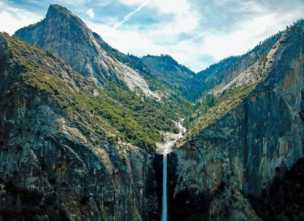
A total of 2,425 feet (739 meters) falls from the upper to the lower fall in Yosemite National Park's Yosemite Valley. When the water flow is at its highest in late spring, it is a significant draw for visitors to the Sierra Nevada National Park in California. Thousands of waterfalls may be found in Yosemite National Park, ranging from massive waterfalls with a half-mile cascading water to little streams of white water that fall only a few feet.
The ideal time to see Yosemite's waterfalls is in the spring when the tremendous snowfall of the previous winter has melted and flowed into the Pacific. The best time to visit waterfalls is in May and June when they peak. Many are down to a trickle or dry up entirely by the end of summer.
33-Waimea Canyon State Park
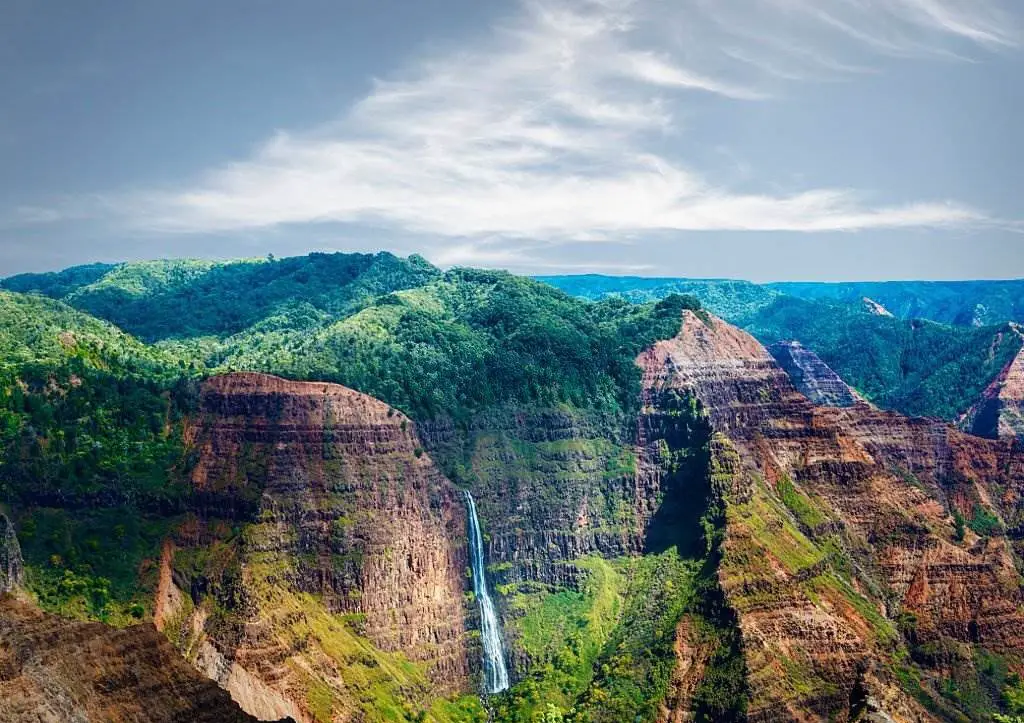
The "Grand Canyon of the Pacific" is Waimea Canyon near Waimea, Hawaii. After American explorer John Wesley Powell visited the island of Kauai in 1869, the name erroneously credited to literalist Mark Twain became well-known.
A river carving its way through the lava and basalt structures of the area created Waimea Canyon. Ten million years ago, a central volcano on the canyon's surface collapsed, significantly impacting the canyon's formation. The Waimea Canyon is one of the world's most beautiful natural wonders, thanks to Mother Nature. The Waimea Canyon is a naturalist's dream: its lush vegetation, towering cliffs, pink and green hues, tumbling waterfalls, and stunning rainbows.
34-Saguaro US
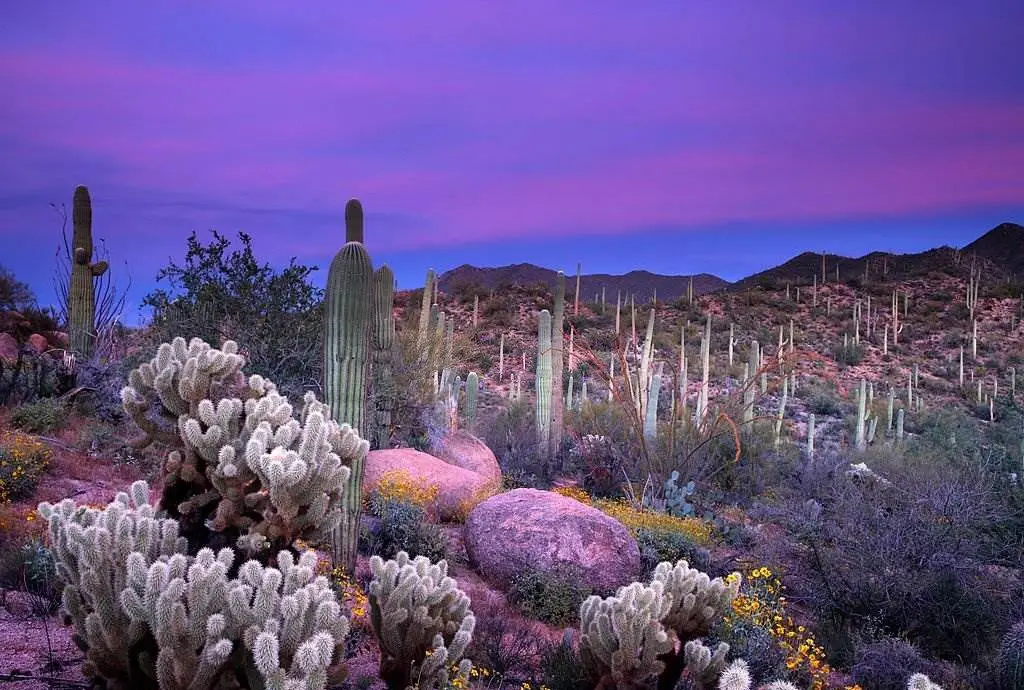
Embodies the spirit of the American West. As a representation of the American Southwest, we are often exposed to images of the cholla cactus. Visiting the Sonoran desert isn't complete without seeing one of these florae. Most people have been awestruck by these enormous green columnar cacti. The saguaro cactus is much more significant to the indigenous Tohono O'odham people living there.
To the Tohono O'odham, these massive cacti aren't just plants; they represent an entirely new species of human being, and as such, they are highly revered members of the tribe. Succulent saguaro cacti can grow up to 40 feet tall in the United States and are the tallest cacti found in the country. 78 feet was the record for the tallest saguaro cactus.
The saguaro cactus's growth occurs at the tip, or very top, of the cactus' column. A saguaro cactus can take up to ten years to grow one inch tall. A saguaro cactus can reach a height of six and a half feet when it is 70 years old, and it will begin to bloom at that point. With maturity, a Saguaro Cactus can grow as tall as 15-16 feet and develop its first limb. During its 200th year, the saguaro cactus reaches its maximum height of 45 feet.
35-Mount Rainier
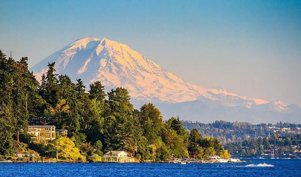
Mount Rainier (14,410 ft [4,392 m]) is the highest mountain in the Cascade Range in Washington. It is located within Mount Rainier National Park, about 40 miles (64 kilometers) southeast of Tacoma. The mountain is only a million years old, having been sculpted by a series of lava flows that began about that time. Approximately 150 years ago, a dormant volcano erupted.
Rainier is encircled by the most extensive single-mountain glacier system in the United States outside Alaska, spanning 100 square miles (260 square kilometers). In addition to the more than two dozen named glaciers, the broad summit is also home to numerous smaller patches of permanent ice and snow. One such patch is the Nisqually Glacier, which has retreated and advanced over the last 150 years, providing scientists with valuable information about global climate change patterns and trends.
Liberty Cap, Point Success, and Columbia Crest are the three most prominent summits on the mountain (the latter is the summit on the caldera's rim). With dense groves of evergreen forests on its lower slopes, stunning subalpine, and altitude meadows, waterfalls, and lakes, Rainier is a popular destination for tourists and locals alike. The Cascade Range's Mount Rainier is a vast, active stratovolcano located about 59 miles (95 kilometers) south-southeast of Seattle. The Cascade Volcanic Arc's tallest peak is Mount Rainier at 14,411 feet (4,392 m), making it the highest mountain in the contiguous United States and the highest in the Cascade Range.
Mt. Rainier is among the most destructive volcanoes in the world, and it is included in the Decade Volcano list because of the high chance of an eruption in the near future. Because of Mount Rainier's huge glacial ice cap, significant lahars are possible, posing a hazard to the Puyallup River Valley. According to the US Geological Survey, around 80,000 people and their homelands are at risk in Mount Rainier's lahar-hazard zones.
36-The Grand Teton - National Park
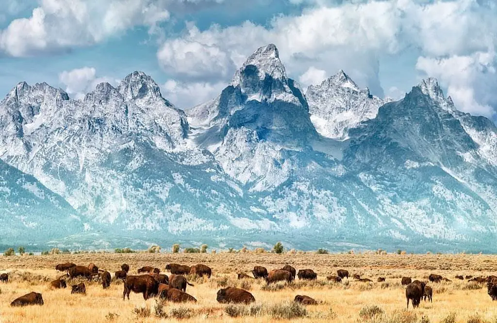
Grand Teton National Park in Wyoming is a magnificent national park just ten miles from Yellowstone National Park. It was designated as a national park in 1929 to prevent the land around the Grand Teton mountain range and its lakes from being exploited commercially. In 1950, the protected area's boundaries were expanded towards the valley below. With its 310,000 acres of topography ranging from summery wildflower meadows to roaring whitewater streams, this genuinely unique federal park is one of a kind. The oldest rocks in the National Park Service can be found in these ancient mountains, which date back over 2.7 billion years.
There are also several tranquil lakes with deep blue pools, mimicking the calm and hue of the glaciers that formed them. As the Snake River slithers through the park, lush woods coat the mountainsides, providing habitat for various fauna and vegetation, some of which date back to the prehistoric age. In northwestern Wyoming, there is a United States national park. The park's 1,300 km2 (110,000 acres) comprises the Teton Range's critical peaks and most of the northern Jackson Hole Valley.
The John D. Rockefeller Jr. Memorial Parkway connects Grand Teton National Park to Yellowstone National Park, which is only 10 miles (16 kilometers) away. The Greater Yellowstone Ecosystem is one of the world's most extensive intact mid-latitude temperate ecosystems, including almost 18 million acres (73,000 square kilometers). Grand Teton National Park visitors enjoy mountaineering, hiking, fishing, and other outdoor activities.
Backcountry camping locations can be reached by more than 1,000 drive-in campsites and more than 200 miles (320 km) of hiking paths. One of the few spots in the world to capture Snake River fine-spotted cutthroat trout can be found in the park. Privately owned motels, lodges, petrol stations, and marinas can all be found in Grand Teton National Park, managed by the National Park Service.
37-Death Valley
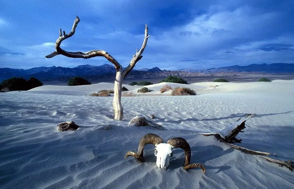
In eastern California's Mojave Desert, on the Great Basin Desert's eastern boundary. Few places on Earth are hotter than this desert during the summer months. The Badwater Basin in Death Valley has a depth of 282 feet (86 meters) below sea level, making it the lowest in North America. Mount Whitney, the highest peak in the contiguous United States at 14,505 feet, is 84.6 miles (136.2 kilometers) east-southeast of this location (4,421 m).
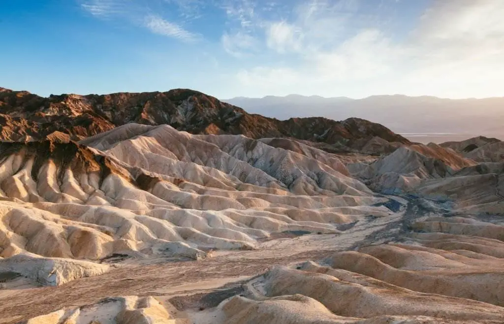
Death Valley's Furnace Creek recorded a peak temperature of 134 degrees Fahrenheit (56.7 degrees Celsius) on July 10, 1913, making it the planet's record-holder for the warmest air temperature ever measured at its surface. Some modern scholars, however, question this reading and others made during that period, more than a century ago.
38-Mount Washington
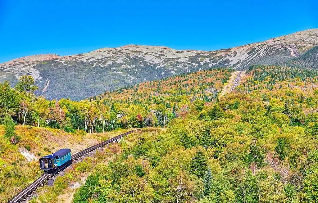
At 6,288.2 ft (1,916.6 m), it is the highest point in the northeastern United States and the most visible mountain east of the Mississippi River. The mountain's unpredictable weather has earned it a bad reputation. The Mount Washington Observatory recorded a wind speed of 231 miles per hour (372 kilometers per hour) at the summit on the afternoon of April 12, 1934, the world record from 1934 to 1996. Mount Washington holds the record for the highest observed wind speed in the absence of a tornado or tropical cyclone. The peak can be found in Coös County, New Hampshire, as part of the Presidential Range of the White Mountains.
The mountain's peak is in the township of Sargent's Purchase, part of many unincorporated townships. Mount Washington State Park occupies an area of 60.3 acres (24.4 hectares) surrounding and includes the summit, while practically the entire mountain is under the White Mountain National Forest. It is possible to get to the peak of Mount Washington through the Mount Washington Cog Railway and the Mount Washington Auto Road. Hikers flock to the peak, which the Appalachian Trail crosses. Annual cycling and running races like the Auto Road Bicycle Hillclimb & Road Race are popular hobbies.
39-Hocking Hills State Park
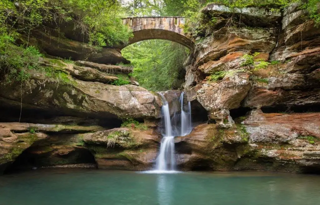
It is located in the Hocking Hills region of the United States state of Ohio. Hocking State Forest borders parts of the park. Over 25 miles (40 kilometers) of hiking trails, rock formations, waterfalls, and underground caverns may be found within the parks.
Attractions include Ash Cave, Cantwell Cliff, Cedar Falls, the Conkle Hollow Nature Preserve, Rock House, the Hemlock Bridge Trail to Whispering Cave, and Cantwell Cliff. Most of the park's 200 campsites are powered, making it easy for campers to be comfortable. In addition to the nearby hiking trails, the campground includes flush toilets and hot water showers, vending machines, a camp store, and a swimming pool. Many cottages and hotels may also be found in this area.
40-Sequoia & Kings Canyon
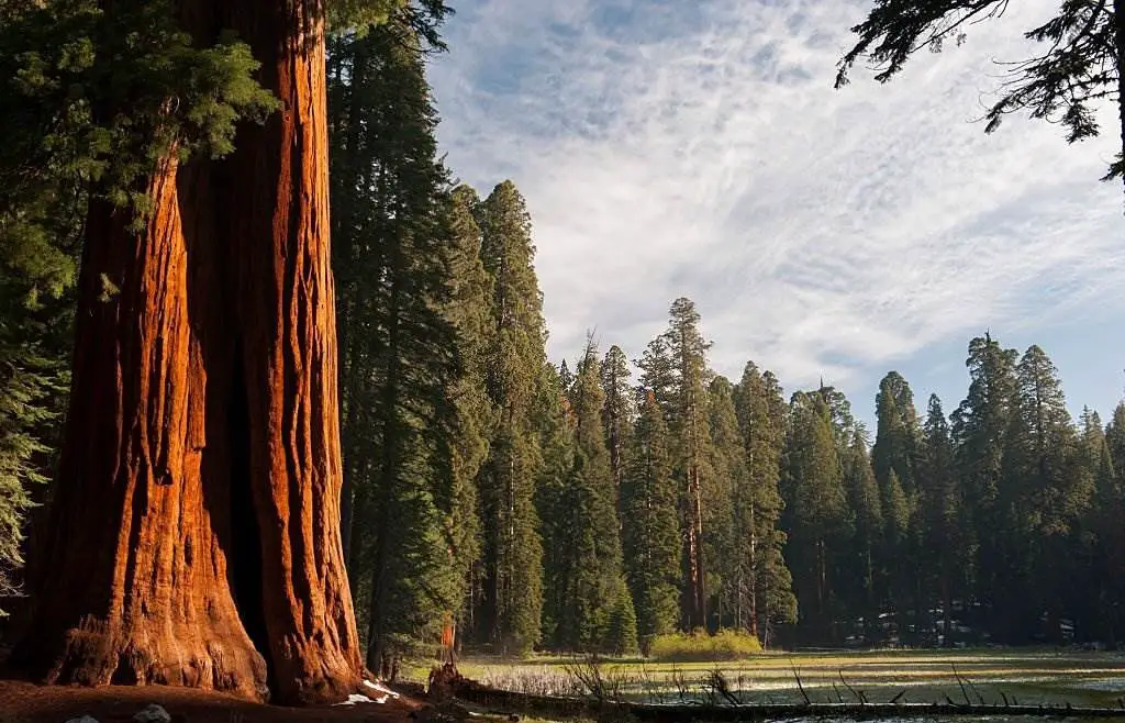
Southern Sierra Nevada east of Visalia, California, is an American national park. On September 25, 1890, the park was created to save 404,064 acres (631 square miles; 163,519 hectares; 1,635 square kilometers) of forested mountain terrain. Mount Whitney, at 14,505 feet (4,421 meters) above sea level, is the highest point in the contiguous United States, with a vertical relief of approximately 13,000 feet (4,000 meters).
The area has two national parks, Sequoia and Kings Canyon National Parks, which the National Park Service administers as one entity. In 1976, the Sequoia-Kings Canyon Biosphere Reserve was established by UNESCO.
Sequoias, including the most giant tree on Earth by volume, may be found throughout this park. Big trees abound in this area, including five of the world's top ten tallest, where the General Sherman tree thrives.
Located in Kings Canyon National Park's General Grant Grove, the Gigantic Forest is accessible via the General's Highway, which connects it to the General Grant Grove and other giant sequoias. Sequoia and Kings Canyon National Parks share 202,430 acres (316 sq miles; 81,921 hectares; 819 km2) of old-growth woods. There is a resemblance to the pre-European occupation of the southern Sierra Nevada terrain in the parks.
41-Black Hills & Badlands
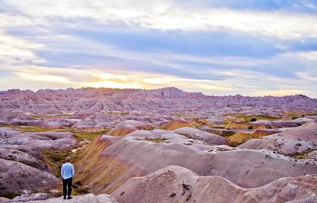
Black Hills destinations include Mount Rushmore, Custer State Park, and Wind Cave, as well as the otherworldly Badlands, Devil's Tower, and otherworldly Badlands in the east and west, respectively. But that's just the tip of the iceberg. The Black Hills, an oasis in a sea of grassland, are home to nearly five million acres of forest and mountain terrain, a rich Western heritage, stunning natural beauty, and significant adventure.
On Dec. 20, 1939, the Black Hills & Badlands Tourism Association (BH&B) set out on a quest to make the Black Hills and Badlands region a must-visit destination.
42-Upper Falls - Powerful Waterfall on the Yellowstone River
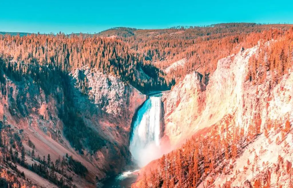
The Upper Falls, 200 feet wide and 50 feet high, is Michigan's tallest and widest waterfall. Take a stroll along the paved quarter-mile path to the observation locations. Take the 93 steps to the brink viewing platform to get a close-up glimpse and feel the spray on your skin. If you've got the stamina, take the paved walk to the river's edge and descend the 112 stairs there.
43-Tahquamenon Falls State Park's Lower Falls
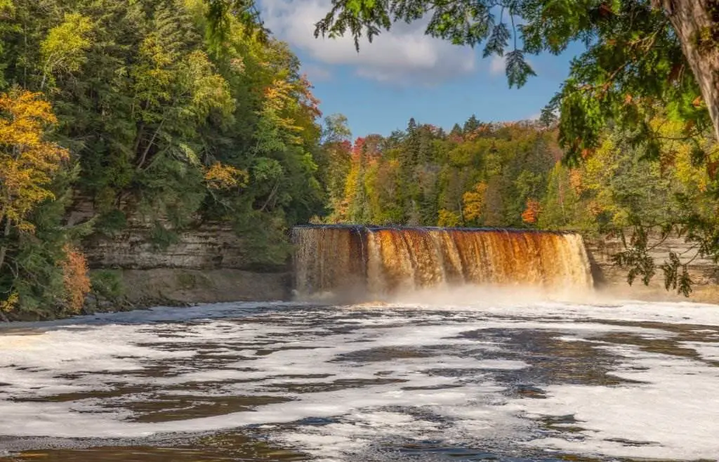
Tahquamenon Falls State Park's Lower Falls is a beautiful natural wonder in Michigan. The park is known for its stunning waterfalls and scenic beauty. The Lower Falls is one of the main attractions within the park. It consists of cascades and rapids along the Tahquamenon River, creating a picturesque and mesmerizing sight. The water of the falls is notable for its amber color, caused by tannins leached from the cedar swamps the river drains. Visitors can enjoy hiking trails, and scenic overlooks, and even take boat tours to explore and appreciate the natural beauty of Tahquamenon Falls State Park's Lower Falls.
44-Monument Rocks, the Chalk Pyramids – Kansas
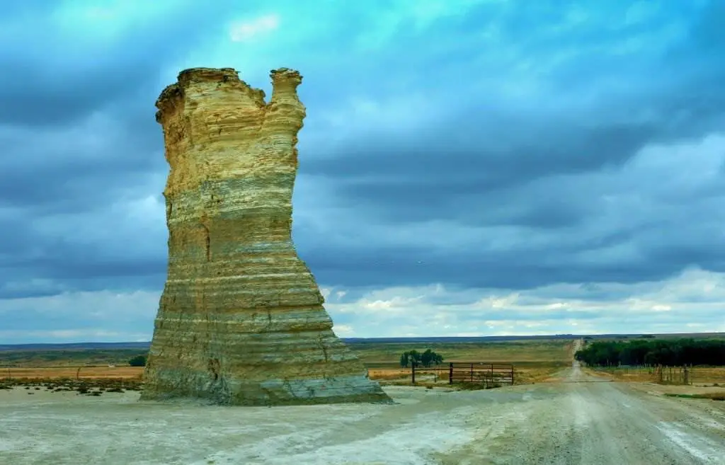
A collection of rock outcroppings along US-83 in western Kansas goes by the names of these two places. Signs are posted at the 6-mile gravel road turn-off from both directions. If you gaze in the right direction from US-83, you can see Monument Rocks off in the distance.
When a seabed was eroded during the Cretaceous Period, the 70-foot-tall sedimentary formations of Niobrara Chalk formed. A vast seabed covered much of what is now North America about 80 million years ago. From year to year, the margins of the rock formations in this limestone alter. Keep an eye out for rocks that may be damaged.
Monument Rocks, like the Castle Rock Badlands, are located on privately owned rangeland but are open to the public during daylight hours as a courtesy to the owners. It is strictly forbidden to enter the Chalk Pyramids after dark. Drones are also banned from flying over chalk formations. Please take care of your rubbish and dispose of any you discover.
National Natural Landmark status for Monument Rocks was granted by the US Ministry of the Interior in 1968. Since then, Big Basin Preserve, Baker University Wetlands, Baldwin Woods, and Rock City have all been declared National Landmarks in Kansas.
45-Hells Canyon National Recreation Area USA
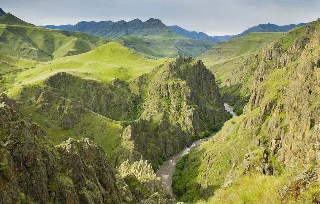
It is a national recreation area in the United States of America located on the Oregon-Idaho border. The recreation area, which the US Forest Service manages as part of the Wallowa-Whitman National Forest, was established by Congress and signed into law by President Gerald Ford in late 1975 to protect the Hells Canyon area and the Snake River corridor between Hells Canyon Dam and the Oregon–Washington border.
The Hells Canyon Wilderness covers approximately 215,000 acres (335 square miles; 870 square kilometers) of the recreation area. The recreation area contains roughly 900 miles (1,400 kilometers) of hiking trails. The area is primarily located in eastern Wallowa County, Oregon. There are smaller sections in southern Idaho County, Idaho, northern Adams County, Idaho, and northeastern Baker County, Oregon.
Conclusion:
The United States of America is a vast continent with a wide variety of natural attractions to explore, and we hope that our article covers all that you need. If you have any notes regarding our website content, kindly don't hesitate to contact us and send all your notes with feedback to [email protected] as we always care about our readers to make them reach what they are searching for.
Related Topics:
North America Travel Guide & Advisory
41 Top-Rated Attractions & Things to Do in USA
12 Top-Rated Tourist Attractions in Eugene, Oregon
10 Top-Rated Things to Do in Coos Bay, Oregon
12 Top-Rated Attractions & Things to Do in Medford, Oregon
20 Top-Rated Tourist Attractions in Oregon
9 Top-Rated Campgrounds Near Hood River, Oregon
12 Top-Rated Things to Do in Florence, OR
12 Top-Rated Things to Do in Jacksonville, Oregon

